
This morning I woke up around 5am at Stanimal’s. I knew I could sleep a bit longer so I rolled over. Then a little after 6am I finished up some writing quickly. Last night I had gotten way too tired and began to doze off while I was writing.
Around this time Daytona Mike was making pancakes with Geo. Geo was hiking the AT earlier this year and got injured. Right now he’s hanging out helping at Stanimal’s. Then he’s going to probably get back on trail after he heals up! I got packed up for the most part and then we sat down for breakfast. I ate about 6 blueberry pancakes, which is impressive because I normally don’t eat breakfast. Then I used up 2 hot chocolate packets by making mochas with hot coffee. I bought a box of 8 and really only needed a handful of them.
Punisher and I at Stanimal’s this morning.
After finishing breakfast I finalized the blog for the day. I hadn’t added photos yet, titled them, or done the final edit. It was still early though! I knew I had time. I got that done and then finished packing. Per usually I have way too much food. I could have gotten less and just eaten up what I have. But I get tired of things so easily. I wind up holding on to food items for so long because I don’t want to eat it or waste it. A classic conundrum.
Before we left I finished off the half gallon of milk that I got yesterday. Then Daytona Mile and Geo drove us back to the trailhead. I knew that leaving the trailhead we were going to have a big climb. In 2023 I actually slack packed these next 15 miles. I remember the climb being pretty hard, and it went on for hours.
The next couple of miles were pretty easy and the climbing definitely didn’t start right away. I decided to put on Into the Wild to maybe finish that up today. It’s a really great story and I enjoy how Jon Krakauer talks about similar characters in history, many of whom suffered similar fates to the protagonist Chris.
Making our way up one of the first climbs of the day.
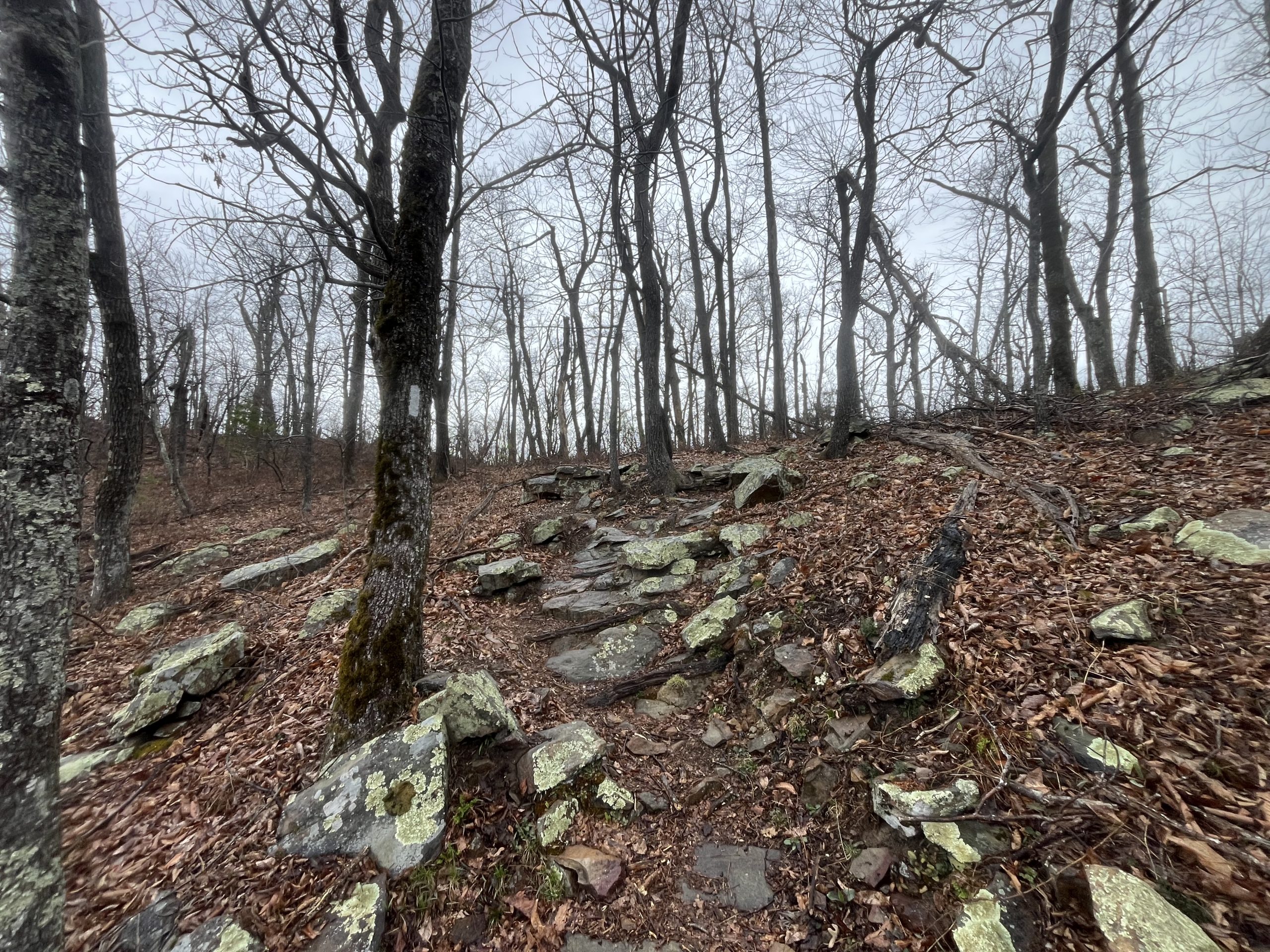
After an hour the climb began to get going, but started with relatively gradual switchbacks. The first leg of the climb was better than I’d remembered. It was also raining on us lightly and had been for most of the morning. But thankfully the rain was light enough that I didn’t feel the need to put a rain jacket on. I wasn’t getting too wet and didn’t want to get sweaty on the climb. After a couple of miles we reached the first high point. I remembered though that this climb had a few different tiers, so we weren’t even close to finished.

Heading up the rock steps on the first climb out of Glasgow.
Once you reach Little Rocky Row there is an overlook which was lovely. It was still raining lightly but I stopped off for some photos and videos. Then used brief service to get my blog posted and edit my video a bit. I’d try to finish uploading everything sometime between here and the final high point on this climb. From this point I began descending briefly. Then another climb began, which was way steeper than before. It was only a half mile or so, but the grade was about 1,200 feet per mile. Which is very steep! I managed to keep going but I definitely slowed down a bit on this one. Then up towards the top there were some long rows of stone steps. Those looked really cool, weaving up the mountain side.

It was a misty day as it rained lightly on us this morning.
After getting on top of those next cliffs the trail leveled out for a few miles. There was brief elevation gain here and there but not much. I got everything uploaded around this time which was great. Then we continued to climb up toward Bluff Mountain. This part of the climb was much more gradual in comparison to the last one. Up top of the mountain there is the old foundation for what might have been a fire tower. There is also a memorial up there for a young boy Ottie who hiked all the way up to this point while he was lost. Sadly he must have succumbed to the elements, and passed away right here on top of the mountain a century ago.

On top of Bluff Mountain.
Once we reached Bluff Mountain we began descending for a couple miles. Then had a few rolling hills to go along before the final descent down to Reservoir Road. We passed a father and daughter on our way down who were out doing a section. Then got down to the road a little while after that. In 2023 when I was in this area I actually slack packed to this road. My buddy Tripod was going to meet us there with our stuff. He watched Roxy the dog for the day which was a great break for her and Boosted. Then brought pizzas and sodas for us and we camped right there by the road snd suspension bridge. I actually irritated my shin on the way down and had a sharp pain in it for the next couple of days. I remember it all like it was yesterday.

Crossing over the suspension bridge about 15 miles into the day.
Down at the road we saw another hiker sitting by the suspension bridge. He was waiting on the father and daughter who we had passed a couple miles back. We talked to him for a bit about the AT and other trails. It seems like he hikes alot and has completed a cumulative section hike of the entire AT. He let us know there was a pretty big group of girls ahead of us.
We crossed over the suspension bridge and then had a pretty cruisy next couple of hours. There was a bit of elevation gain here and there, but not much. Eventually we passed the group of girls we had been told about. There were about 3-4 moms in the back of the group walking. Then a few girls up ahead of them. It took a few minutes to pass the girls because they seemed to speed up when they saw us. But we just kept on cruising and eventually passed once we’d been tailing them for a little bit.

After a while the rain stopped and it turned into a beautiful day.
Over the next couple of miles we walked by a long stone wall. Apparently there were a lot of homes out here about 100 or so years ago. It seems like the forest service probably made the people leave and bought their land from them. I spent some time thinking about the area and what it would have been like to live out here. There was a lovely river that flowed along through here. That would have been really nice to live alongside. And this section of forest was actually surprisingly flat. So I could imagine being able to erect homes just off the river.
We passed by a shelter after another mile or so. Then only had 2 miles to go to get to US Route 60. Over the last few days I’ve been walking to a guy named Counselor on Instagram. He wanted to come out and meet us with some trail magic. For anyone who has reached out on here and on Instagram about bringing our trail magic, thank you so much! And I’m sorry if the timing hasn’t or didn’t work out for us to coordinate. I’m very grateful for everyone’s support and have received alot of messages. At times it’s just a bit tough to read them all in time and be able to coordinate meeting at a road. I try to save and remember about all of the people and messages, but definitely don’t do a perfect job! I apologize to anyone who has tried to coordinate meeting but I didn’t respond in time or make it work. Thank you just for reaching out and trying, it really means the world to me!

Up top of one of the next climbs, which opened onto a wide open ridge.
When we got to the highway I could see a few vehicles parked at the trailhead. Counselor was there set up waiting for us. He had brought subway sandwiches, sodas, Gatorade’s, ice cream, and snacks! At this point we were 22 miles in for the day and hadn’t stopped off yet. So I was looking forward to enjoying a nice long break. And also being able to get a bunch of calories in. Originally we had planned to do about 30 miles to a tent site. But we were feeling good and had made surprisingly good time even though we started at 8am. So we decided we would go another 14 miles after this road. Which would put us at about 36 miles for the day.
Counselor was super nice and it was great to hang out for a bit and chat with him. He has come out alot over the last few years to trail magic hikers. He even had met and supported some hikers that I knew of, which was really cool to hear. While we sat there I ate an entire foot long sub and drank a soda. Then I wound up eating about half a pint of ice cream. That was a solid lunch break for sure.
We hung out there for nearly an hour before we began getting ready to head on. With so many more miles looming ahead of us I knew we couldn’t stick around for to long. It was almost 4pm and we had another 4+ hours of hiking to go for the day. So we said goodbye to Counselor and headed on out. It was so ridiculously nice of him to drive all this way to meet us and bring us lunch! What a guy. That made my whole day. And is going to make the rest of the day a whole lot easier too. Now that I was stuffed to the brim with food I was ready to crush another 14 miles.
When we left the road we began a gradual climb for the next mile or so. Then it really pickup and got quite steep. I just thought that I was feeling sluggish at first. Then realized that it was just the grade of the climb. It was a real but kicker. My calves were burning as I made my way up. And I could tell that my pace wasn’t as quick as it typically is on a more gradual climb.
It took about an hour to get up to the top of Bald Knob. There were some nice views as we got up there and I was glad to finish the climb. It really whooped me! I was lagging behind a little bit for sure. The trail dropped down a for a little bit after that. But not for long. Then we began the climb up to Cole Mountain and Cole Mountain Bald. This area was beautiful because it was entirely open and exposed. You got 360 views of the surrounding area.
After this most of the climbing was done for the day. We still had a few brief climbs to go, but nothing more than a mile or two at most. There was a descent off of the bald for a mile or so. I drank some water and ate a couple of snacks. We still had another couple of hours to go. So I wanted to get some calories in quickly. I also realized that one of my Nutella uncrustables had apparently exploded in my right chest pocket. There was Nutella all over the pocket. A problem which I would have to deal with at the next water source.
After descending down to a road briefly we began another climb. It brought us up through a grassy valley type area. Then up to Tar Jacket Ridge. Another exposed ridge with great views. We still had plenty of daylight too which was great. There wouldn’t be too much night hiking in the forecast for us tonight.
We got on to the top of the next ridge pretty quickly. This climb was a whole lot more gradual than some of the ones we did earlier today. I was feeling good and ready to continue cruising on to camp for the night. The trail brought us down to another dirt road. There was a fire pit just off the road filled with beer bottles and cans. It blows my mind that people will drive in with beer and trash, and then leave it when they drive away. It’s not even like they have to carry it out on foot. They could just load it back into the truck that they probably loaded it out of. Those things really boggle my mind.

Heading up toward the final high point of the day.
Leaving the road we had a gradual bit of climbing left. But it wasn’t anything much at all. It began to get dark but I managed to keep my eyes adjusted for another mile or two. Then after I kicked a couple roots I knew it was time to turn on my head lamp. We walked for another mile and then passed a water source. At this point we were only a half mile from the Seeley-Woodworth Shelter. So we filled up water here just so that we wouldn’t have to search for the spring by the shelter in the dark. Then we walked and prayed that the upcoming shelter would be empty. We haven’t seen a single thru hiker all day long, so it’s hard to imagine it would have anyone inside.

The sun setting just before we got to camp for the night.
When we arrived at the spur trail we walked down. And when I saw a bear hang only 5 feet high in the air by the shelter, I knew we were in trouble. We walked up to the shelter and only saw a few people inside. But they were spread out filling the entire place. A dog began to bark and the guy next to him hushed him. He saw us but didn’t saw anything about maybe moving over and making room for us. He just pretended like we weren’t even there and didn’t acknowledge us at all. I didn’t have it in me to ask them to make some room. Even though it was a 6-8 person shelter and there was more than enough room. It was just after 8pm, so not wildly late either. But it became clear that those guys were going to budge. So we began walking around to look for tenting. If you do stay in a shelter on the AT, I would recommend leaving space for other hikers to arrive later in the evening. Especially in a large shelter. It isn’t an uncommon thing. And makes it easier for everyone so that no one has to move around later on in the night.
That was a pretty brutal hit, honestly. We really only did the 36 mile push so that we could end in a shelter. It makes life a whole lot easier when you don’t have to set up a tent. And it wasn’t exactly an easy day today. In 36 miles we did 10,500~ feet of elevation gain. Possibly our biggest day yet out here. Then had to walk around to find someplace flat by the shelter to get set up. We wound up finding a nice flat spot with room for both of our tents.
I got my tent up quickly and got everything set up inside. I couldn’t resist walking over to the food bag hanging nearby and take some pictures and videos of it after. It is hung so low that even I could reach it with my arm stretched out. I’ll never understand why someone would even bother hanging their food if they are going to have it so low. At that point it just makes more sense to sleep with it, so that a bear doesn’t take it. Hanging a bag low is a death sentence for a bear. If one is nearby it could easily take the food. Then that bear becomes a problem and will likely come back again looking for more food. Those bears are regularly put down because they become a problem. And the main cause is people improperly hanging or storing their food. Hanging a bag too low is even worse than sleeping with it, in my opinion.
Once I was set up I got into my tent for the night. I didn’t have the energy to make a hot meal. Even though Counselor gave both of us a delicious dehydrated meal today! I’ll just have to enjoy it another night. It was late and I just didn’t want to bother with the whole process. I got into my bag and did my stretching routine. I took some more ibuprofen too, just as precaution. Though my knee has felt so much better the last two days. I only took ibuprofen this morning and then never took it again over the course of the day. And my knee still felt great and didn’t cause me any issue. The surrounding area is still sore to the touch. But I don’t have any pain or discomfort while hiking thankfully.
After I stretched I did my writing and got some video work done too. Then finally rolled over and called it a night some time after 11pm. Tomorrow it looks like a couple hikers are going to come out and see us! They are friends of Punisher, but I actually met the one guy Star Lord when I was in the wind river high route on the CDT last year. I’m not sure exactly what the plan is. But it looks like we’ll be seeing them and either having lunch together or possibly get picked up by them and spend the night somewhere. We’ll just have to see!
If you enjoyed this blog and would like to support my hike by buying me a soda or a snack along the way, there is a “Tip the Author” button below! It links directly to my Venmo. Any and all support is incredibly appreciated!


