
Hello everyone! How’s it going? Welcome back to another chapter of this wild adventure we call the PCT.
In this post, I’ll pick up exactly where I left off in my previous entry, “Listening to the Whispers of the Sierra.” I had just arrived at Cabtree Camp—and was about to have an unexpected encounter.
I’m proud to share the map I created for this section of the PCT. It took me a bit longer, but it includes far more details about the route. The satellite image is from the same season I was on the trail, so you’ll see the snow-covered areas exactly as I did.
I also marked some of the possible exit routes from the trail to give you a better sense of where I was. The small gray tents represent potential campgrounds for this part of the journey—but if you want to know whether I actually made it to them, you’ll have to dive into the story.
Trail Update #46
The Search for a Group
There I was, deep in the Sierra Nevada, looking for a group I could feel safe and comfortable hiking with.
Some of my friends were still behind me on the trail, while others had chosen a different way to approach this adventure. Bit by bit, I started to realize something—it was becoming harder for me to join someone to hike the PCT together. But in the Sierra, with all the snow, river crossings, high mountain passes, and the remoteness of the trail, I knew I had to change. I had to start hiking with a group.
Now, this wasn’t because I didn’t get along with other hikers, or because I dreamed of being a mountain hermit (well… maybe that last part was a little true, but I didn’t know it at the time!).
Building a Team
To hike with a group, I had to be ready for a bit more structure—and I had to coordinate with others on how we would move forward. That might sound easy, and actually, I was used to organizing treks with my friends back home. But after more than a month of solo hiking, this shift felt like a big change.
I believe every PCT hiker decides how they want to live this journey. Some start off in groups, others go solo, and many end up joining hikers with a similar style along the way. By this point on the trail, most groups were already established. Even solo hikers had formed mini-groups for the Sierra section.
That’s exactly what I saw when I arrived at Cabtree Camp—tents gathered in small clusters.

Tents at Cabtree Campground
Hello Darkness, My Old Friend
I was deep in this mental debate when a voice caught me by surprise. In perfect Spanish, I heard, “Hello, my old friend.” I turned around—and there was Saida.
I had met Saida at the start of the Sierra section, back in Kennedy Meadows. We had spent hours talking about what it meant to be walking the PCT.

Saida and Me at TCO
Expressing emotions in the language you learned from birth is very different than doing it in one you picked up as an adult—or at least that’s how it is for me. Though it was clear Saida spoke English fluently, there was something special about sharing in our native language.
A Quick Introduction
Saida led me to where her trail companions were. Four guys were getting ready for dinner. I joined their circle, pulled out my stove, and quickly whipped up my beloved ramen bomb.
They welcomed me warmly, asking my name, where I was from, and how my hike had been going. They had left Kennedy Meadows a day before I did and hadn’t stopped in Lone Pine, which explained why I hadn’t seen them earlier.
The chat was short—by then it was already 7 p.m., and they planned to start their climb to Mt. Whitney at 2 a.m. They asked if that worked for me, since I had just arrived at camp.
I was a bit tired, but I figured that a few hours of rest would be enough to tackle Whitney. So I told them that if they’d have me, I’d love to join them.
They laughed and said, “Of course we don’t mind if you come with us, more friends, more fun!”
Diving Deep Before Reaching the Summit
Many PCT hikers set themselves the goal of reaching the summit of Mt. Whitney before the sun rises. They pack light and carry just enough to wait at the top and witness that magical moment. Since the idea is to hike up and return to the same camp, we took only the essentials: a light lunch, jackets, headlamps, ice axe, sleeping pad, and sleeping bag. The plan was to reach the summit and wait there for sunrise—sipping coffee or even having lunch while the first light filled the sky.
That night, I had everything ready and lay down to sleep. But it was hard to fall asleep, which was unusual for me. By then, I was sleeping quite well on trail. My mind was uneasy about joining this group. I worried I’d end up being a burden to them. Maybe they had only invited me out of pity, seeing me alone, and had made an exception just for that night.
I knew these were irrational thoughts—ones that wouldn’t find answers as I wandered through the darker corners of my mind. Still, I couldn’t switch off. I found myself diving deep inside my own thoughts, trapped in that atomic submarine of a mind, drifting into shadowy places where I felt vulnerable.
Suddenly, a sound pulled me out of the dive. Tum tum turuntun tum tum turuntun. I turned my head from side to side, and then I realized—it was my alarm. Time to get up and meet my new hiking companions. Time to start the climb.
My first thought was, “Wow, this is going to be tough. You didn’t rest well. Your mind kept you far from deep sleep.” But there was nothing I could do about it. I couldn’t rewind time. So I did what I always do in moments like this—switched off my mind, and got ready to go.
On the Way to the Roof of the U.S.
I packed my backpack, secured everything inside the tent, and stepped out into the cold night. Outside, I found Saida’s four friends getting ready to leave. We greeted each other and continued with our preparations.

Jumper at stream crossing
My tent is a non-freestanding Durston, so once I took out my trekking poles, I had to lower it to the ground. I got busy doing that and couldn’t help but think of my mountaineering instructors. In particular, I remembered Juan “Puchero” Bauer, who always told us:
“To keep your tent safe when you’re not there, use big rocks. REALLY BIG ONES.”
So that’s what I did. I piled large rocks over the wind fabric, using the tarp from my backpack to protect the tent from getting torn by the sharp edges. While I was doing that, Saida came out from her shelter and we finished getting ready to head out toward the summit.
Walking in the Night
We walked together in a single file. Whenever the person up front lost the trail, we spread out to search for the way forward. The truth is, we lost the trail pretty often. It was hard to stay oriented in the dark.
We were used to hiking in daylight, following the path ahead. Even if we lost sight of it, we could usually spot where it continued from a distance.
But at night, it was a whole different story. We stayed alert, but still, at almost every switchback, we kept going straight and had to backtrack to get back on track.

Searching the trail in the night
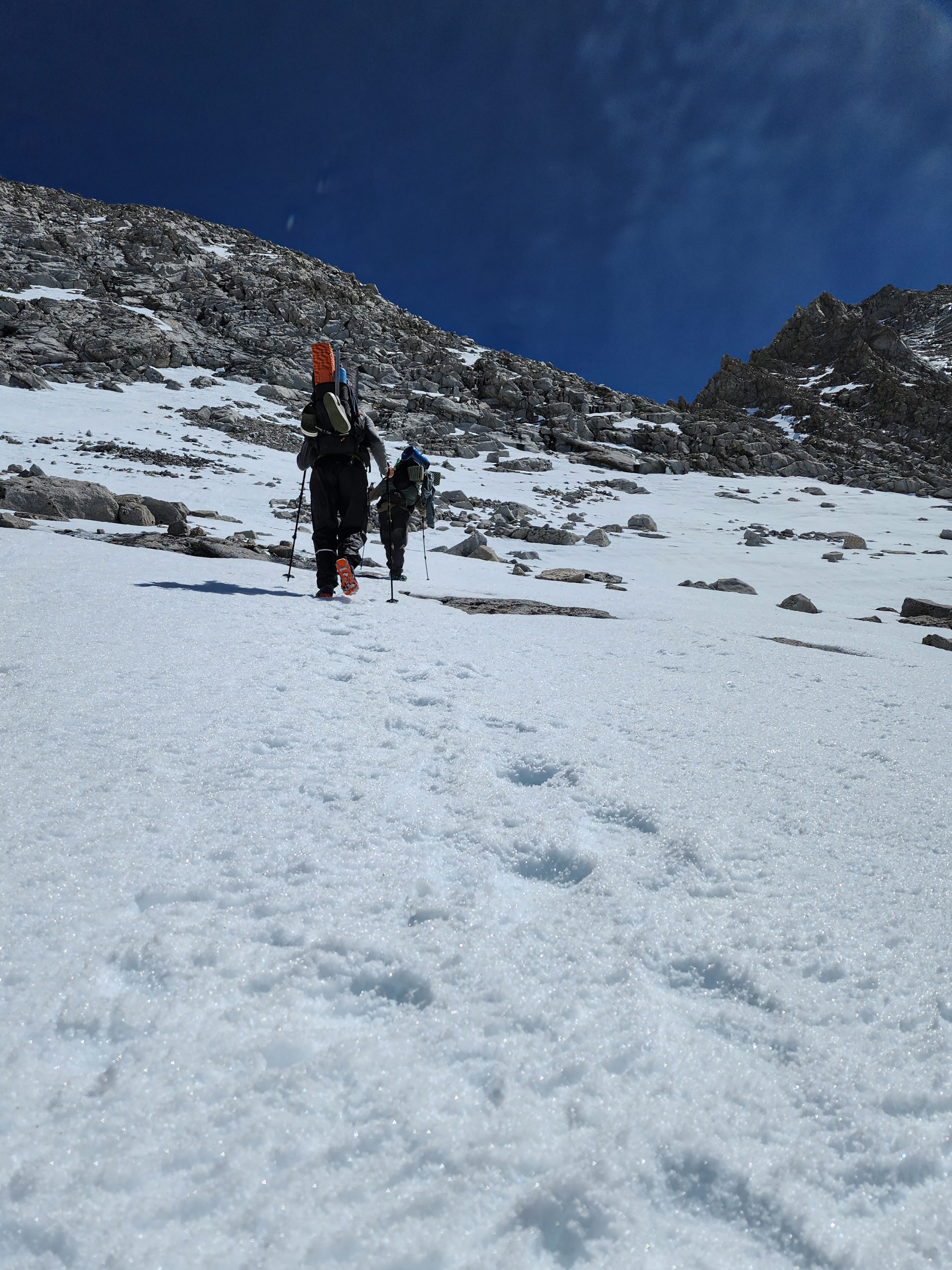
When we reached snowy areas, following the trail became impossible. The snow was frozen solid, like ice. Telling the difference between a boot print and the natural roughness of the snow was more wishful thinking than reality.
Mission Impossible
Our shouts echoed with every step:
“It’s this way… I see footprints… The trail’s over here… Footprint!… I don’t see anything… Careful! Frozen lake!”
At one point, Saida fell into one of those traps that looked like solid ice but weren’t. She ended up soaked, the water reaching above her waist.

Little by little, we gave up on the useless search for footprints, legs, and sharp rocks. We started trusting our instincts to guide us along what we thought was the trail. We also had GPS tracks on our phones, so we picked a target and moved towards it, letting the mountain show us its own way.
Optimization
We spoke less and moved faster. The same doubts about which path to take kept coming up, but we solved them more easily each time. In daily life, we try to optimize everything. We have apps that tell us the shortest way to get somewhere. But out here in the mountains, that’s not possible.
You can always try to find the route that uses the least energy. And if, by some miracle, you do, the energy you save is minimal.
That’s why the familiar question, “What’s the best route to do this?”, makes no sense here. It takes time for your mind to adjust. It takes time to switch off that optimizer chip and simply move forward. But once your eyes and hands gather enough information, you develop a natural feel for solving the classic problem of “Which way should I go?”
It may sound silly, but it’s what we do every day in the city—always seeking the best result with the least effort. Out here, it’s different. Once you know where you’re going and which areas are dangerous, the best thing you can do is keep moving. Your path may not be the most efficient, but it will still take you to your goal.
This hike was becoming a way of life. When we faced a new problem, we solved it the best we could. We learned from those solutions, but never stopped doing what we set out to do: move forward. That sense of freedom made us more present. We enjoyed the moment and let go of the obsession with doing everything the “right” way.
My mind started recognizing these patterns and comparing them to everyday dilemmas back home—dilemmas where my life wasn’t at risk. But here, it was. And yet, I felt much less stressed.
Gaining Elevation

View of Whitney Valley
Step by step, we gained elevation. The valley where our tents were pitched seemed far below now. The first rays of sunlight began to win the battle, allowing us to finally see the mountains around us.
The light was a relief. It made it much easier to follow the trail and lift our gaze from the ground. That’s when I noticed I wasn’t feeling well. My focus shifted from the trail to my own body. I felt out of breath, sweaty, and was struggling to keep up.
It didn’t seem like the group was moving fast—it was more like I was unsteady and out of sync.

The group moving over footprints
Because of that, I moved to the back of the line. There, I could step more securely in the footprints left in the snow by the others. That saved me a lot of energy. These guys were helping me achieve my goal.
At one point, we saw tiny lights above us. Very faint. When I realized they were headlamps, my heart sank. The mountain had seemed huge, but without a reference point, I hadn’t fully grasped its scale.
Those tiny dots were people—likely PCT hikers who had started earlier than us and were now hundreds of meters higher. The trail felt endless, and instead of going up, it seemed to lead deep into the mountain.
First Light Views
Around 4 a.m., we realized we wouldn’t reach the summit in time for sunrise. Those tiny lights were at least two hours ahead of us, and even they were still far from the top.

This realization frustrated us. We wouldn’t get to watch the sunrise from the summit. That feeling hit us hard—but then vanished just as quickly. We were in an incredible place, doing something incredible. The group wasn’t blaming the slower hikers. Instead, we supported each other, taking breaks to stay together.

Junction between PCT and Mountaineering Whitney Trail
I was exhausted, but the sunlight gave me a small boost. We had reached a long series of switchbacks that felt endless. My eyes were closing. I was walking almost blindly, following the footsteps ahead of me, with Saida just a few meters behind.
I didn’t understand what was happening. I wasn’t moving fast, drinking a lot of water but hadn’t gone to the bathroom. At first, I thought it was because I felt shy—there were people everywhere. But then I started to suspect the altitude was messing with me.
From my mountaineering course, I knew altitude affects your body’s adaptation. Lack of oxygen causes heavy breathing, which leads to water loss through your breath. Your blood pressure rises too—partly due to exertion, partly due to the lower atmospheric pressure.
When we reached the junction where the PCT meets the trail from Lone Pine, I had an intrusive thought: This is it. You have to stop here. You can’t go any higher.
Don’t Give Up
I was at 13,500 feet. The summit was still 1,000 feet up, but my morale had collapsed. I sat on a rock. My companions looked at me but hadn’t noticed my state. My chest rose and fell rapidly. I couldn’t calm my breathing. One of them, the tall blond guy, approached and offered me a piece of chocolate. I took it and thanked him.
That’s when my mantra came to me:
“Never give up. You still have time to spread your wings and start again—to celebrate life and reach the skies.”
Those words echoed in my mind, and with them came peace. I took a sip of water, stood up, and told the group,
“Let’s go, we’re really close. Just one more stretch and we’ll reach the top of the United States.”
Part of me said it to lift their spirits, but mostly, I needed to hear it myself.
The Last Stretch

As I walked, I was surprised to see the summit was almost free of snow. I had expected more snow at that height, not less. But now I understood what was going on.
We had spent the whole day on the inner side of the valley, trying to reach the main ridge. This final stretch of trail was flatter and had been exposed to the sun for longer hours. That’s why the snow had melted so fast.
This last stretch was taking everything I had. A light heat crept in, and I started to sweat uncontrollably. I was gasping for air. My body felt numb, like I wasn’t even inside it anymore.

Roadrunner trying to find strength
Each step drained me. The slope seemed endless, and my companions were getting farther and farther ahead.
I kept my head calm, trying to find my breath and manage my emotions. I focused on putting one foot in front of the other. My mind was foggy, my vision was blurry, and my legs felt like lead.
Then something shifted. In the distance, I saw a small structure. A roof shaped like a triangle—the kind we call two waters in South America—and walls made of rocks just like the ones I was walking on.
There was no doubt. That was the hut on the summit.
Whitney Hut

Last steps to Whitney hut
That image silenced all the alarms in my body. The horizon became clear again, and my legs, now lighter, moved with joy toward the final point.
I had made it. I was on the roof of the United States, at the summit of Mt. Whitney, after walking over 1,200 km. My joy and pride were written all over my face. I looked inside the frozen hut and was in awe of how surreal that place was.

Whitney Hut
Inside, a wall of ice stood tall. It had likely slipped in through the door, trying to take shelter from the early sun that now threatened to melt it into tears.

Me at Mt. Whitney Hut “the shelter of the ice”
The ceiling was filled with signatures from people who had been there before. I scanned them with my eyes but noticed something—they weren’t PCT hikers.
So I left my mark. Proof that a crazy hiker from Uruguay had passed through here, on a journey from the Mexican border all the way to Canada.

My signature
Yes, Diego. You’re doing it. You’re RoadRunner now. This is a milestone in your life—and maybe for your country too.
Hi Saida my old Friend
After those moments of reflection, I stepped out of the hut, left my backpack, and grabbed my camera. The summit was only a few meters away.
In the distance, I saw Saida standing right at the top, with the mighty sun shining over her.

Saida on the top of U.S.
That image meant the world to me. It was the symbol of our friendship, solid and real. Seeing her there made me feel like we had truly made it. She was going to be my trail family for the challenges ahead in the Sierra Nevada.
Summit Feelings

Mt. Whitney Summit Plaque — 14,505 feet (4,421 m)
Reaching a summit is always something special. The path to the top is tough, draining, and intense. Along the way, you wrestle with your body, pushing your limits further and further in a slow, grinding process where time itself seems to stretch.
In those final steps, pride, emotion, and adrenaline take over. It feels like a surge of euphoria rushing through your body. The emotions are overwhelming, but like every intense feeling, they fade—just a bit slower than they arrived.
Then it hits you—you start to realize where you are. And suddenly, you shift from a sense of dominance to one of surrender. Pride gives way to humility, because you see how small you are compared to the sheer size of the mountain.
Up there, you understand that you made it to the top only because the mountain allowed you to. Even the slightest change in weather would have made it impossible to be there.
Thankfully, we were able to sit down and have a meal beside the hut.
The greatness of the Mountain

My Sierra family at the top
That feeling of fragility, the deep silence, and the breathtaking view spark something inside—peace and gratitude for simply being there.
All the effort, all the discipline it took to stand in that place rushes through your mind. All that hard work might be enough for the mountain to let you step on its back—or it might deny you in a moment, with no more effort than it takes for us to brush a fly off our shoulder.
The silence, the wind, the views—they all tell you this moment is unique, unrepeatable. A fleeting gift from the world, showing you just how awe-inspiring it truly is.

Mountains surrounding Mt. Whitney
I was standing there at the summit, not conquering the mountain, but visiting it. It let me step onto its terrace for a brief moment, to take in its views.
But that was only half the journey. The most important part was still ahead—making it back down safely to our camp in Cabtree.

View of the Mountains and Owens Valley
Starting the Descent
We shared a beautiful moment up there—six of us, now bonded by the climb. As daylight revealed our faces more clearly, we started to get to know each other. The mountain had forged our bond, and now, during the descent, we began to shape this brand-new connection.

Family going down
I started to feel like part of the group, gradually connecting with each person and sharing small moments that brought us closer. The first one I spoke with more deeply was the tall blonde guy who had offered me chocolate when my body had collapsed on a pile of rocks for a quick rest. His trail name is Jumper, and he’s from Germany. The first thing I noticed about him was his kindness and easygoing nature. He gave off a sense of purity and sincerity from the very first moment, always carrying a lighthearted and genuine sense of humor.
Getting to Know My Sierra Family
Salty Chef
When it comes to solidarity, I have to pause and mention the oldest member of the group—Salty Chef. He was a natural leader, inspiring trust with every step he took and every decision he made. To me, he seemed like someone with a wealth of mountain experience, gained not just from time but from deep attention to detail. He was clearly someone who carefully analyzed each move and took the mountain seriously.

Salty Chef making footprints for Jumper
Since it was still early and the sun hadn’t warmed things up much, the snow was rock-hard. Even the slightest slope turned into a slippery slide where you could easily lose control. Our microspikes weren’t quite enough in those moments to keep us from falling. Salty Chef noticed this as he led the way and used his ice axe to carve footholds into the snow, making the descent safer for everyone behind him.
This gesture of solidarity spoke volumes about who he was. Over time, I also noticed he paid special attention to the youngest member of the group.
Hatchet

Hatchet and Jumper going down
Hatchet was the one I had spoken with the least during the day. He was the youngest in the group, and from the moment we started walking in the dark, his agility and boldness stood out. Those are often signs of youth—moving with confidence, not overthinking every step. Young hikers with some experience and no fear tend to be more daring, more willing to push forward even if the path is uncertain. If they take a wrong turn, they simply backtrack and try again. You’ll often see them crouched down taking photos, getting dirty, or playing around in the snow

Hatchet taking a photo of a Marmot
Of course, this isn’t always the case, but from my perspective, that kind of free-spirited movement often belongs to the younger hikers.
When we began hiking at night, I could tell Hatchet was younger just by the way he moved while we were all trying to follow faint tracks in the snow. He was the first to figure out how to navigate that unfamiliar terrain—snow under the stars. That spark and energy are something you often see in the young, and out here, it shows.

Hatchet in his side quest
The relationship

Saida, Jumper, Salty Chef, and Hatchet (from closer to farther)
As we continued descending, I chatted with Saida about what a beautiful day it had been. She told me she had already summited Mt. Whitney the year before while hiking the John Muir Trail. Back then, the conditions had been completely different. Although 2023 was a heavy snow year, she’d summited a month later than now, so the trail had been mostly snow-free.
She was amazed at how much the mountain’s difficulty changes depending on the weather.
I told her how I had started feeling like part of the group and how exceptional everyone seemed. She was really happy about that and glad I had joined them because she was looking forward to chatting and sharing the trail with me. Partly because I speak her parents’ language, and partly because I had been hiking the PCT solo, and she wanted to hear more about that experience.
Father and Son
She had been hiking almost from the start with Jumper, Salty Chef, and Hatchet. They had started back in mid-March, so by now, they had spent nearly two months together—sharing almost every moment. They were tightly knit, but even so, Saida sometimes wondered what it would be like to hike solo or with different people.

Searching the path
During our conversation, I asked her what those early days with her trail family had been like. That’s when she told me something that connected all the dots. Salty Chef and Hatchet are father and son.
My mind went boom. I couldn’t imagine how profound it must be to experience something like the PCT with your father. I instantly thought about what it would’ve been like to hike with my own dad when I was younger. I think I would have loved that. My parents worked very hard to give me a good education and a better life than they had. I’m forever grateful for their sacrifices, but sometimes when we focus so much on providing, we miss out on spending real quality time together.
I’m sure this thought will linger in my mind as I keep walking the trail—watching the bond between these two hikers the PCT placed in my path. Now that I think of it, I’d love to take my dad to the mountains someday. Just to have him there, enjoying being lost in nature for a little while. I think he’d really like that.
Air Down Below
Unlike the ascent, the way down slipped through my fingers. Only the last stretch felt long, but my eyes were now lost in the stunning turquoise-blue lakes I hadn’t seen in the dark. Their waters were so clear that the sky above looked like a deep midnight blue. The contrast between the snow, the rocks, the shimmering water, and the green trees turned the scene into something out of a dream. Little by little, the green of the trees began to reclaim its place, and with it came a sense of comfort, as if the land itself was welcoming me back.

Jumper and Hatchet in the Valley
Gone were the exhaustion, the breathlessness, the teary eyes, and the blurry vision.
I started thinking about what had happened to me on the way up—why had my body felt so slow, heavy, and unsteady? Now, I felt so much better. So much so that I could talk, enjoy the moment, and time seemed to fly.
Sure, descending isn’t as physically demanding as climbing, but the difference in sensations was striking. I began replaying the last few days in my mind, analyzing how I had eaten and hydrated. Everything had been fine in that regard—I had even had a rest day in Lone Pine.
And then, as I pieced things together, something clicked. It had been just over 24 hours since I was in town, down at 1,200 meters above sea level. In that time, I had hiked 35 kilometers to Cabtree, set up camp, talked with my friends, had dinner, and gone to sleep around 10 p.m. Then, at 2 a.m., my summit day had begun.
To reach the peak, I had to cover another 15 kilometers, climbing up to over 4,400 meters. In just 30 hours, I had walked 50 kilometers and gained at least 3,600 meters in elevation. Not only was this physically exhausting, but my body had also gone from 1,200 meters to 4,400 meters in just one day—hardly enough time to adjust to the altitude.
The Effects of Altitude
As I kept walking, my mind wandered back to my mountaineering training in Argentina. Altitude affects each person differently, but the underlying cause is simple: the higher we go, the less air pressure there is above us. In other words, the weight of the air pressing down on our bodies decreases.
But our circulatory system doesn’t adjust instantly. If our heart keeps pumping with the same force, the reduced external pressure makes our blood pressure rise.
Dehydration
This increase in blood pressure, combined with lower oxygen density, forces our bodies to compensate. Our breathing rate increases, and when we add physical exertion to the mix, we end up gasping for air more often.
Every breath releases tiny water particles from inside our bodies. At altitude, with an elevated heart rate and increased respiration, we lose water much faster than at lower elevations. If we don’t adjust our water intake, dehydration sets in quickly.
My Experience
I had faced altitude challenges before, but this time, I had pushed my body to the extreme. The physical toll was massive, and my system hadn’t had enough time to acclimate.
This was just a hypothesis, but it explained why I felt so much better once I descended.
Cabtree and the Next Goal
Once we all regrouped at camp, we agreed to push forward to be closer to our next big climb. Tomorrow, we would face the formidable Forester Pass and its 4,000-meter elevation.
Salty Chef and Hatchet decided to rest at camp, eat something, and continue in a few hours. I told them I preferred to pack up and keep moving. They were supportive of my decision, and we agreed on a campsite about 8 kilometers ahead. It was a great plan—it would shave two hours off tomorrow’s hike while letting everyone move at their own pace.

Being at a lower elevation, we wouldn’t have to deal with snow, though we might have some river crossings. But by this point, I felt pretty confident about handling those.
Campsite
The trail was peaceful, and near camp, I had to cross a river where the water reached my knees. I wasn’t in the mood to soak my shoes, so I switched to my sandals and hiked the rest of the way in them.

I found a spacious, flat area where we could all set up our tents. I pitched mine, laid out my sleeping bag and shoes to dry, and, just as I finished, my friends arrived—only about 15 minutes after me.
We sat together, had dinner, and unwound from the long day.
Debriefing

Leaving Whitney behind
We talked about everything—the day’s challenges, how we had felt, and what we had learned. I told them about my struggles with altitude, and they couldn’t believe how bad I had felt without saying anything. We laughed as I joked that I had a reputation to uphold.
Then, we got more serious, analyzing our experience on the trail.
We realized that for climbing, we preferred the snow to be firm—it made each step easier and prevented us from sinking and wasting energy. But for descending, it was the opposite. Hard snow increased the risk of slipping and falling. Ideally, we wanted the snow just soft enough to grip without sinking too much—because we all knew the nightmare of post-holing when conditions turned against us.
As we went to sleep, one thought lingered: today’s challenge had been tough, but tomorrow’s would be even greater.
4:30 AM Wake-Up Call
The alarm went off at 4:30 AM, abruptly cutting through my deep, peaceful sleep. It had been a long time since I’d slept so soundly—so calm, so exhausted. I hesitated for a second, tempted to roll over and steal a few more minutes of rest. But then I remembered: today was an important day.
We had planned to start hiking around 6 AM. Our campsite was still quite far from Forester Pass, tucked away in a beautiful grove, safely distant from the frozen wasteland that the early morning snow would become. I noticed my tent had condensed overnight, and the foot of my sleeping bag was slightly damp. Being so close to a water source, this wasn’t surprising.

Tent Condensation
Slowly, I started packing my things, keeping my ears tuned for any sounds outside. Around 5 AM, I heard movement—Hatchet was up. Inside my tent, I had already packed most of my gear. I didn’t want to be the one slowing down the group on my first day.
Good Morning
Stepping outside, I saw my hiking partners beginning their morning routines. Some were packing their backpacks, others were taking down their tents. The only one missing was Saida—probably the last to wake up. Hatchet and Salty Chef were chatting in Dutch, a language completely indecipherable to me. Meanwhile, Jumper was ready, comfortably seated on a log, waiting.
Around 5:30 AM, Saida finally emerged from her tent, her face carrying the unmistakable weight of sleep. That’s when it hit me—early mornings weren’t their thing. They probably started hiking much later every day.

Saida
Our Strategy
The plan was to tackle most of the climb while the snow was still hard and reach the pass just before noon. By then, we hoped the snow would have softened enough to provide traction but not so much that we’d be postholing the entire way up.
So, we set off together. Just like the day before, our group’s pace was surprisingly synchronized. The forests of the Sierra had a glow I had never seen before—open, clear, and entirely untouched. Other than the trail and the occasional marker, there were no traces of human presence in these lands.

Walking in the Sierra
Meeting New Faces
The trail climbed steadily, and the trees grew sparser. We followed a river, which we’d inevitably have to cross. As we reached the crossing, we ran into another group of hikers.
They were a diverse bunch—hikers from different backgrounds, including Asians, Europeans, and Americans. I approached a tall, blond guy and greeted him.

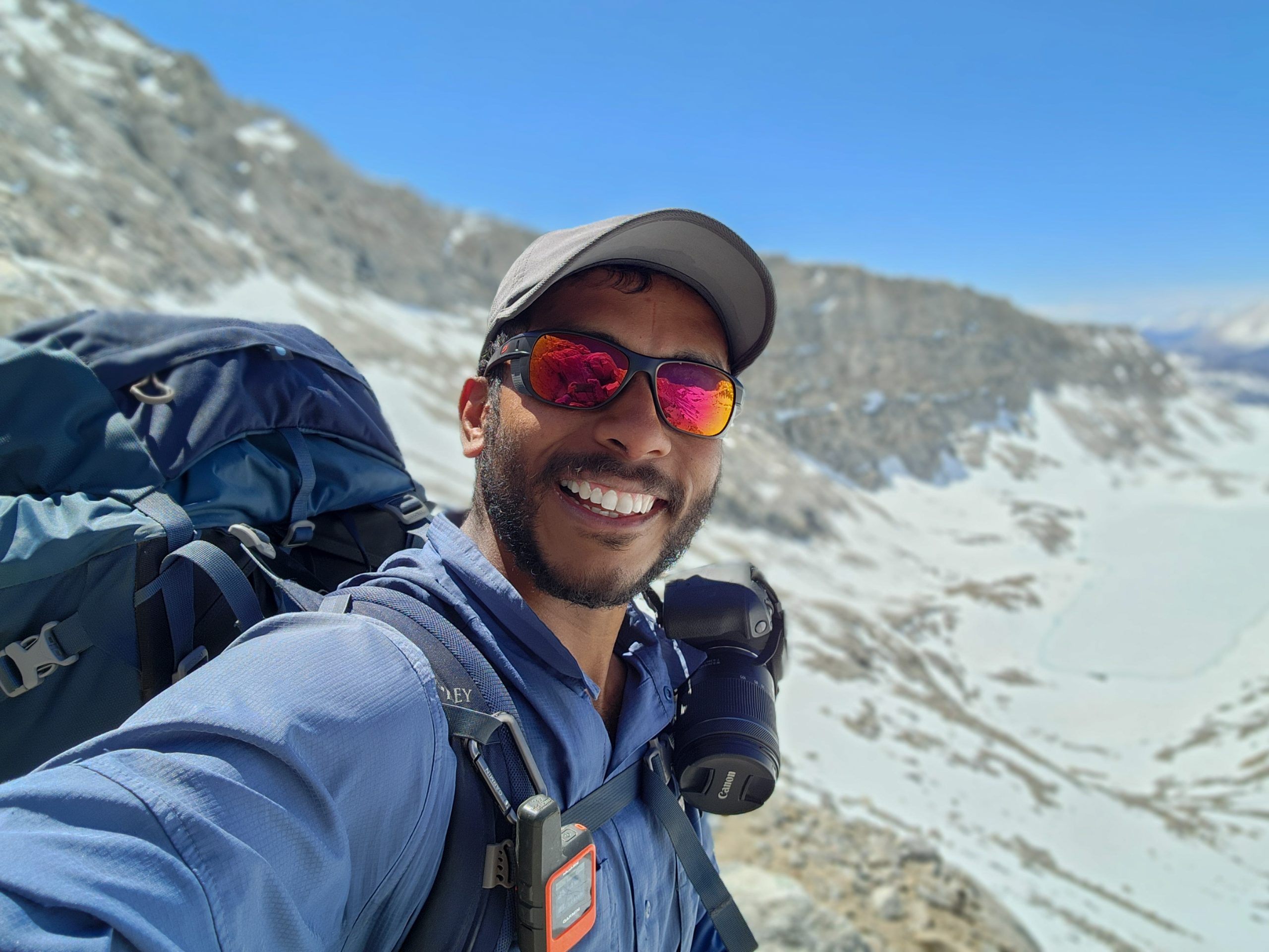
A new Roadrunner on Trail
“I know you,” he said. “Your flag is from Uruguay, so you must be Roadrunner.”
I nodded, confirming his guess, and asked for his name.
“I’m also Roadrunner,” he replied with a laugh. “I heard about you from another Uruguayan hiker who was always trying to catch up with you but never could.”
“Oh,” I chuckled. “You must’ve met Rafael.”
He smiled. “Oh, that’s his real name? He insisted we call him Coyote because he was always behind you.”
A Strange Feeling
I let out a nervous laugh. A few things struck me as odd. First, that Rafa had given himself a trail name. Usually, hikers earn their names from others based on their quirks or habits. Second, that he was keeping such close track of my whereabouts without ever mentioning it to me. We had the means to communicate via inReach, but the truth was—we never really did.
At some point down the trail, I figured I’d run into him and we’d have a good laugh about it. Maybe he’d share his adventures, too.
Breaking Chains
We chatted with Roadrunner USA’s group for a while. They were waiting because one of their friends didn’t want to get her only dry leggings wet and was changing into something else.

River crossing
Then, out of nowhere, she appeared—choosing to cross the river without clothes. In everyday life, this would have been shocking. Seeing someone strip down in public is just not something you see every day. But out here? It barely registered. After a quick laugh, we all moved on, treating it as the natural thing it was.
That’s when I realized—I had changed. My mindset was different. I was more open, more adaptable. The things that once seemed unusual now felt normal. I had shed so many unnecessary constraints, and in doing so, I felt lighter, freer.
Jumper and I helped Roadrunner USA’s group cross the river before we each continued on our separate paths. It was an incredible encounter between two groups, and now, we’d be watching out for each other as we climbed higher toward Forester Pass.
Approaching the Pass

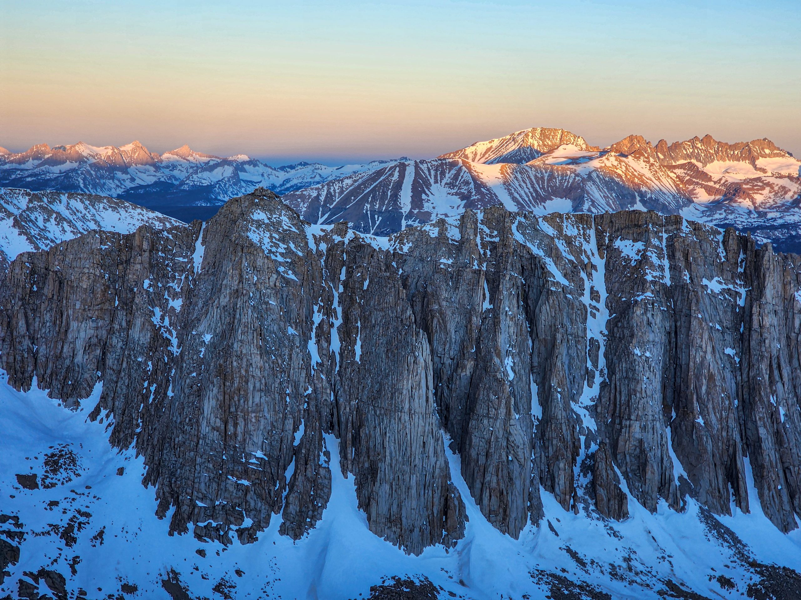
Head of the valley composed of Caltech Peak, Andy’s Foot Pass, Forester Pass, and Junction Peak
We were approaching the wall of mountains we had to cross to continue our journey. As you walk toward these areas, the wide-open view you have starts to narrow gradually. It feels like you’re slowly stepping into a prison cell—the walls begin to rise monstrously around you. Snow starts to take over the terrain, and the cliffs look completely impenetrable. Your eyes scan for the way out of this prison, searching for the path that will lead you beyond this enclosure.

My group at the head of the valley
The trail keeps heading straight toward that impossible-to-climb wall. You look for that so-called “low point”—the mountain pass—that allows you to cut through the ridge and cross to the other side of this giant. It’s like a colossal rock formation, one that could crush you with the slightest movement, leaving you no chance to escape its destructive grip. Your only chance to make it through is to pass silently, without disturbing the stillness of its eternal slumber. If you do, you can only hope that its mood won’t decide you don’t belong there.
And if you realize you’ve awakened the colossus, you must show it the utmost respect. Acknowledge its beauty and the pristine landscape that surrounds it. Show that you understand you are standing in a sacred place and that your only purpose is to admire it and continue your physical, mental, and spiritual pilgrimage. I believe this is the essence behind the Leave No Trace principles we follow on the trail. I’ll talk more about that another time, but for now, I needed all my focus and strength to reach the top of Forester Pass safely, together with my friends.
Time to Climb
We reached the base of the steepest climb. From there, we could see a narrow snow-covered passage that would allow us to cross to the other side of the ridge.

First clear view of Forester Pass
We sat briefly on the rocks to discuss our strategy. According to the map, the trail veered to the right, zigzagging up through a series of switchbacks that were mostly covered in snow. The final climb was about 200 meters of elevation gain over a short distance, meaning it would be a steep ascent.
Sitting there, we analyzed the terrain and decided to take a more direct route through the snow, aiming to intercept the PCT at the 3,950-meter contour line.

PCT blue line, our plan in purple
Since the trail was mostly buried under snow, following the switchbacks didn’t seem like the best idea. Instead, climbing straight up—even if it was brutal—felt like the more efficient option.
The Strategy
Salty Chef and Hatchet started first, followed by Jumper. Saida and I brought up the rear.
Jumper and Salty Chef
At that moment, I remembered my mountain instructors and all their advice for tackling a steep ascent. Short steps, keeping the elevation gain per step as minimal as possible. I recalled how they used to say, “Short steps, short steps—like an old man. You’ll go much farther this way than if you climb like a wild colt.”
I chuckled to myself, replaying those words in my mind while trying to find that steady rhythm. It wasn’t easy in the snow—your feet naturally seek solid ground, but I did my best. When I started losing my breath, I shortened my steps even more and slowed my pace. My goal was to keep moving, even if it was just little by little, rather than stopping frequently.
When I lifted my head, I noticed that Salty Chef, Hatchet, and Saida were no longer close to me. The only one I could see was Jumper, sitting on a rock a bit ahead. I turned around and saw my friends climbing a few meters behind me, moving steadily and at a good pace. So, I faced forward again and kept taking my old-man steps.
Short Steps

I caught up with Jumper, who had stopped to take off his jacket. He was drenched in sweat and breathing heavily. I told him to pace himself, that we were getting closer but still had a way to go. He looked at me with his usual cheerful expression, grinned, and said, “Yeah, yeah, when I get to the top, I’m gonna order a Coke from that store up there.”
I stared at him for a second before realizing he was joking, and we both burst out laughing. Jumper had this way of catching you off guard with his humor—you’d almost want to ask him, “Are you okay? What are you talking about?” His jokes were always delivered in the most serious tone, which made them even funnier, especially in our exhausted, high-altitude state.
I smiled and told him, “Short steps, Jumper. We’ll get there.” Then I refocused, set my sights on a pile of rocks ahead, and kept going.
Visualizing the Infinite
When I reached the rocks I had aimed for, I turned around—and was left speechless.
The towering walls had lowered, but in their place, more snow-covered peaks stretched endlessly across the horizon. Below, I could clearly see the green valley where we had camped the night before—though from up here, it looked more like a dark valley, the blinding white snow making even the clear midday sky seem darker.

Climbing towards Forester Pass
Three frozen lakes caught my eye—ones I hadn’t noticed when we passed by them earlier. Their turquoise-blue color stood out vividly against the snow-covered shorelines. A few meters below, my friends were battling the climb, their heads down, completely focused. As I watched them, I spotted four small black specks in the white landscape. They were moving. It took me a moment to realize—it was the Roadrunner USA group, making their way toward the start of the final climb to Forester Pass.
Cheering On My Friends
I could see that each of my friends was in a personal battle against the brutal incline. Their gazes were locked on the snow, their bodies leaning forward, using their packs to help power each step. I shouted down to them:
“Let’s go, friends! Almost there! Short steps, short steps—like an old man! You got this!”
Salty Chef raised one of his trekking poles in a tight-fisted salute.
“That’s it! Keep it up! You’re doing great!”
At that moment, I felt like I was back in my volleyball days, hyping up my teammates, or in one of those intense functional training sessions I used to love. I thrived on encouraging others, seeing the determination in their faces, watching them push just a little beyond their limits.
I turned back to the mountain, scanning for where we could reconnect with the PCT. I needed to be careful not to veer too far left, where sheer rock walls loomed. As I searched, I noticed a small snow ridge about 60 meters above me—piled up, like the edge of a trench. It stretched across my view from right to left, leading straight into the rocky section of the pass.
That must be it.
On the Sierra’s Highway
I resumed my short steps, climbing steadily. About 50 meters below, Jumper followed. I signaled toward my target with my trekking poles. He saw me and gave a thumbs-up—or at least, I think he did at that distance.
The snow here was softer, wetter. Thin streams of meltwater trickled down, forming tiny veins of flowing ice. This section had been exposed to the sun longer, making the snowpack much weaker.
Carefully, step by step, I pushed on until I reached the ridge… It was the PCT.

Trail to Forester Pass
Snow-free… why?
I was puzzled. This section of the trail should have been buried in snow—but it was completely clear. As I followed it with my eyes, I saw where it disappeared under a thick snowbank. It must have been the sun exposure that kept this part clear. I had rejoined the PCT at the perfect spot.
I turned toward my friends below and shouted:
“Let’s go! Almost there! Head this way—the trail is here!”
And then, I started singing. Loudly. In Spanish, of course. My friends wouldn’t understand a word—but they could feel my joy.
Somos de la sangre | We are from the blood
Del Maracaná | Of Maracana
Y somos la locura | And we are the madness
Que picó el penal | That took the penalty
Con el viento en contra | Against the wind
Metiendo pedal | Pushing forward
Repecho y bajada | Uphill and downhill
Desde el litoral | From the coastline
Descolgando el cielo | Unhooking the sky
Tres millones van | Three million go
Color que ilumina sueños | A color that lights up dreams
Orgullo de identidad | Pride of identity
Ice Bridge
A few minutes later, we were all together on the trail. Air and strength were scarce in the group, but the excitement of being there, just a few meters from the pass, made up for everything.

Saida walking in the HW
From below, it was hard to pinpoint exactly where the pass was. Logically, it had to be the lowest point on the ridge, but the terrain was so winding that we weren’t sure if it was that strip of ice and rock we were seeing.
When we got closer, we realized that what had seemed like a small patch wasn’t small at all. In fact, it was quite big. We were standing in front of an ice bridge.

The Ice Bridge
Snow had accumulated in a V-shaped hollow carved into the mountain. That deep cut was likely the result of years of water erosion, shaping the valley over time. Heavy winter snowfalls filled it up, and the steep walls provided perfect shade, keeping the snow protected from the sun.
Crossing it was terrifying. A misstep could mean a free fall straight to the valley floor. It was time to take out the ice axe and get ready.
Crossing the Valley
I gripped my ice axe in my right hand—the one closest to the mountain. My trekking pole was fully extended, held firmly in my left hand.
The scariest part was stepping onto the snow bridge. It’s that split second when you decide to leave solid ground and step into the unknown. It’s the moment when you take the risk, when you dive in. But after a few steps, I realized the snow was firm and well-packed, thanks to the footprints of those who had crossed before us.

Jumper crossing
When you finally grasp that you can control the very thing that terrified you, a rush of euphoria takes over. You feel safe. You feel complete. You even allow yourself to look away from the footprints for a moment and take in the vast drop below.

Salty Chef crossing
At that point, I knew there was no real chance of falling. And even if, by some stroke of bad luck, I did slip, my ice axe would stop me within a few meters.

Hatchet crossing
One by one, we all made it across the ice bridge. The joy was immense—not just for the place itself, but for the effort it took to get there and, most of all, because we had done it together.

Saida crossing
Forester Pass
For the second day in a row, I couldn’t hold back my tears. The mix of satisfaction, awe, and pride I felt in that moment was overwhelming. I thought back to those endless afternoons of deep sadness when the crazy idea of stepping onto this trail was born.

My trail-family at the summit of Forester Pass
Five years ago, I had more doubts than certainties. But one thing was clear: to reach my goal, I had to keep walking. And that’s exactly what I did. Step after step, year after year, I stayed focused. And now that I was here, I was soaking in every second of it.
I felt incredibly proud to be Uruguayan. Somehow, I had made this dream happen with the tools and opportunities available in my country.
My Life
Roadrunner at Forester Pass
In a flash, my entire life ran through my mind. I thought about my parents’ humble beginnings, my years in private schools, and my firm, challenging decision to study engineering at Uruguay’s public university. I had achieved so much, but none of it compared to this. This was bigger.
I had stepped out of my comfort zone.
For a few months, I had broken free from the usual routine—the social pressures, the endless race to accumulate things we think we need. But at that moment, none of those things mattered. None of them were useful here.
And yet, I felt safer and more at peace in this wild place than I ever did surrounded by material possessions.
I felt freer. Less weighed down.
So why, when I’m back in the city, do I trade my time, my energy, and my peace for things that, deep down, don’t really matter?
Right then, I didn’t have the answer. And honestly, I didn’t care to look for one.
All I wanted was to keep walking.
Now the Descent Begins
Seeing the other side of the pass was a beautiful feeling—one that slowly turned into something a bit more intimidating. The mountains ahead looked just as far as everything we had already walked through that morning. Our break at the summit was short—just enough to take in the view and give our bodies a rest. The trail down seemed to follow a ridge disappearing off to our left. Our energy wasn’t the same anymore, and the euphoria of reaching the summit was starting to fade.

Full group going down the pass
There was a lot of snow, but the footprints left by other hikers and the gentle slope made walking quite easy. We hadn’t had lunch yet—we were trying to avoid hiking in soft, slushy snow. So we kept moving until we felt we were close to leaving the snowy zone behind.
As we descended, the pain in my leg muscles noticeably shifted. My knees felt more pressure, my quads were stiff and tight, and each long step brought a sharp discomfort. Luckily, the wind stayed quiet the entire time, so even though the air was cold, it didn’t feel harsh. Our bodies were warm and sweaty—if the wind had picked up, the chill would’ve been unbearable.
Eventually, we reached a sharp ridgeline where the trail seemed to vanish into a steep slope.

Rigde line and Center Peak (3880m)
It was hard to spot a clear path. We stood there for a while, studying the terrain, looking for footprints, cairns, or any kind of marker. Then, in a moment of clarity, Salty Chef looked up, met our eyes, and said: “Let’s make our own path. The snow looks stable—let’s head straight down the slope, aiming for areas with the least incline, and staying away from the lowest points. There’s probably a stream running under the snow down there, and we don’t want to fall through.”
Lunch Time
The trail dropped sharply, but the snow was still perfect for a quick and smooth descent. As soon as we noticed the white blanket breaking apart into scattered patches—connected by snowy veins weaving through emerging rocks—we knew it was time to stop.

Lunch in paradise at Bubbs Creek
I stuck to my usual menu: a tortilla, couscous, and tuna. I was in love with couscous—it was light, easy to digest, and gave me just the right amount of energy to keep going.
Sitting there on those rocks, we all felt ourselves adapting to the terrain. We were more relaxed. I especially noticed it in myself. I had been unsure about my ability to hike through this kind of landscape. But I was getting used to that slippery rhythm, the kind that makes you move fast to keep your balance, rather than stopping to find stability.
Toward Camp
We kept going, feeling at ease now that the snow was behind us. We had already reached two major milestones: Mt. Whitney and Forester Pass. Now we were walking alongside a steady stream called Bubbs Creek.
Back in the lower elevations of the trail, the big trees returned. And just like that, we reached our destination—camp. The spot we chose was right at the border between Tulare and Fresno Counties, near where Bubbs Creek meets Vidette Creek.

Big trees again
We started setting up—looking for flat ground to pitch our tents and designating a shared space. That space was something special to our trail family.
Jumper called it “the dining room”—and there wasn’t much more to explain. He always looked for a flat area where we could all sit in a circle and share dinner together. This simple tradition, mirroring how families gather at the table, felt warm and deeply meaningful. At one point, Hatchet stepped in and got to work.
Campfire
He arranged a perfect circle of stones and brought over a huge pile of neatly cut logs. Then he placed some brown, frayed grass—tied like a loose rope—and began building his magic with care and patience.

Jumper and Hatchet at the campfire
Hatchet studied each branch before choosing it, moving with a calm, natural precision. He had a gift for selecting the right wood—you could see it in how confident and deliberate he was. When it came time to light the fire, he focused entirely on the flame. He watched it, blew gently, adjusted it, and gradually fed it larger pieces of wood, slowly growing it into a strong fire.
If there was one thing missing from that special moment in this pristine place where nature sheltered us, it was a campfire—and now we had it.
But in the first row of flames, it wasn’t our bodies warming up. It was our shoes and socks. We lined them up in a hopeful attempt to dry them, dreaming of something that felt almost luxurious: dry socks for tomorrow’s hike.

Saida pensando en el camino
It might sound like a joke, like a cute little anecdote—but it wasn’t.
We had food. We had water. We were crossing the Sierra Nevada.
But we did not have dry socks and Saida’s face seemed to be longing for that
Reflection of the Day

After crossing these two peaks in the Sierra, I began to understand the unique challenges this terrain brings. I started to learn how to walk on snow, and it wasn’t as bad as I had imagined. I realized I wasn’t getting as tired as I expected, even after long hours of hiking. I felt less anxious and more focused on my body—able to tell when I was pushing too hard and when I wasn’t. I felt more complete.
But more than anything, I realized something important: you can’t know everything about this challenge. What you need is the ability to adapt and to learn.
As an engineer, that’s part of my training—understand the fundamentals and use them to analyze and adapt to new problems. That mindset helped me understand where I was and what I was getting into.
And what I understood the most at that point… was that I knew almost nothing about the Sierra.
The more I learned, the more I realized how little I knew.
That’s what makes it such a challenge: adapting to the unknown.
On the menu for today, we had another mountain pass waiting for us: Kearsarge Pass. We had camped close to the junction where the PCT meets the side trail to the pass.
The trail through the forest was calm and peaceful. We had to take a detour toward a lake called Bullfrog Lake. We had camped a few kilometers before the junction. According to the comments on FarOut, bears had been spotted in the area, and we didn’t want any surprise visitors during the night.

Mt. Hutchings.
A Little Friend
Salty Chef and Hatchet were walking ahead. Suddenly, they stopped and started pointing toward some bushes. We rushed to where they were standing. That’s when I saw it.

Friendly black bear
A small, black, furry friend was staring at us from behind a log. Completely still, eyes locked on us. We froze too. Just as we started making loud noises to scare it off, the little bear turned around and disappeared.
We looked at each other, unsure of what to do. It clearly wasn’t a full-grown bear, but it wasn’t a cub either. It seemed to be alone, but we couldn’t take that for granted.
We kept walking, making noise along the way. We didn’t see any more signs of the bear. It was gone.
Surprise
We kept walking, excited after seeing such a beautiful animal. In that moment, we understood why people sometimes get careless and try to get close. They’re beautiful, fluffy creatures with gentle eyes.
We laughed and talked about how lucky we were to see one safely. Then suddenly, something made everyone stop in their tracks. This time, it was a big one.

Big Boy
In front of us stood a wall of brown fur, walking the trail in the same direction as us. Even on all fours, its back was as tall as Jumper—the tallest one in our group. You could tell it was all muscle. It moved effortlessly, but each step was heavy enough to shake the ground beneath us. We could feel it.
Its coat shimmered as it moved through the dappled light of the trees. The shadows briefly covered its eyes, adding more tension to the scene.
This time, we were scared. We froze. Then we started banging our trekking poles, trying to make noise. It didn’t work.
The bear turned around and looked right at us. We felt tiny—smaller than the scrawny little tree next to it. Its eyes showed no fear, no anger. Just… indifference. As if saying, “Why all the fuss, little creatures?”
Seconds that Felt Like Minutes

Big boy looking us
The moment the bear looked at us, time stopped. My senses kicked into overdrive. Adrenaline surged through me. I scanned the area—looking for signs of danger, for other bears, for other hikers. I noted the trees, the logs between us and the animal.
It was one of those moments that could go either way: a fatal encounter or just a story to tell.
The bear took two slow steps toward us… then turned and walked into the woods. It didn’t look back. It wasn’t in a hurry. It wasn’t worried. It just continued on, peacefully, as if searching for nothing at all.
Warning: I’m being watched
We waited a bit before walking again. If the bear kept going down the trail, it would head toward our next destination—Bullfrog Lake.
Once we were sure it was gone, we talked it over. We agreed that our strategy had worked: don’t run, don’t provoke, don’t look weak. We needed to be careful with encounters like this.
It felt like the Sierra was sending us a warning: You’re doing fine, friends… but remember, this is still the wild. You are small here. I’ll let you admire my beauty—but only if you show respect. I’m watching you. Keep it up.
Bullfrog lake
As time passed and our heartbeats slowed, another familiar companion returned—snow. The trees started to thin, and the patches of white grew thicker under our feet.
Then suddenly, the path opened up and we saw it.

We had arrived at Bullfrog Lake. A dreamlike place, carved by nature herself at her most majestic. The sky was clear. The moon hovered just above the sharp rocky peaks.
The lake was partially frozen, so there was no reflection. Instead, we saw a turquoise pattern etched into creamy white ice—so bright it almost hurt to look at directly.
The only sound was silence. A deep, sacred silence. One that spoke louder than a thousand words.
Climbing Again
Leaving the lake, we had a full view of the mountain pass ahead. On this side, the trail was almost completely clear of snow. It was rocky and steep. The pass sits at 11,709 feet (3,560 meters), and we figured that the elevation difference was the reason there wasn’t much snow left on this section.

Kearsarge Valley and Kearsage Pinnacles
By now, our legs were far from fresh. The morning was still young, but we found ourselves stopping often to catch our breath. Several things played into that. First, the terrain was familiar—rocky trails, no snow, no real surprises—so our attention and motivation dropped a bit. It was also hot. That kind of heat can suck the energy out of you. The cool air from the Sierra kept us moving though. It felt good to walk just fast enough to warm up and shake off that chill.

Kearsage Pinnecles
Another factor was mental. We were getting close to a rest day, and when that happens, your mind drifts. You start thinking about city food, a cold beer, a comfy chair. I was craving clean clothes and a hot shower to help my sore body recover. I also wanted to call my family and tell them all about the Sierra so far. That mix of anticipation and fatigue makes you want to rush ahead, but rushing uphill just makes it harder.
Reaching Kearsarge Pass

Kearsage Pass sign
Step by step… we made it! We reached our third high point in the Sierra section—Kearsarge Pass. It’s a well-known exit point from the PCT into Owens Valley, where hikers can get to towns for resupply. But I think it’s kind of unfair how little people talk about how beautiful it is from up there.
The peaks in this area are dramatic—massive, vertical rock walls that look like they’re about to crumble and fall. The exposure is intense. You get a weird mix of awe and fear just looking at them. Straight ahead, I could see a peak called University Peak.

View of the pass and University Peak
I found it interesting how many peaks around here are named after universities—University Peak, Caltech Peak, and so on. It stood out to me
Black or White… or Maybe Grey
For a moment, I imagined what it would be like to study engineering at one of those schools. How wild would it be to take a weekend break from intense studying and end up in these mountains to clear your head? Actually, I’ve had a few offers to do research or postgrad work at Caltech. I haven’t accepted yet.
I like engineering. I enjoy a good challenge. But this feels like a different chapter. A time to reconnect with nature. A time to grow in new directions. To heal old wounds and open my arms to the beauty of this world.

Big Pothole Lake
Yes, the world is full of injustice. And yes, it’s tough to step outside the system that pushes you to want more, to consume more. Living differently often gets you labeled as weird or naïve. But sometimes, you face two paths: go with the flow, or break away and do things your own way.
If you’re someone who believes not everything is black or white—if you believe in the shades of grey—then maybe you’ll understand. Today, I chose something that’s probably more on the “crazy outsider” side of life… and honestly, it feels pretty damn good. Let’s see where this shade of grey takes me.
Mode city ON
At the top of the pass, the “city mode” switch turned on. Getting to town is always an interesting challenge. That’s when my friends pointed out something I hadn’t realized—they’d hiked out of Kennedy Meadows seven days ago without taking a single rest day. No wonder they were so wiped out and eager to reach town.
Their plan was to take two zero days in town before hitting the trail again. I wasn’t against that idea, but I had to be careful with my budget. Staying in town meant extra costs, and I had to make sure I wasn’t jeopardizing my future on trail.

Hatchet looking the PCT
They invited me to share an Airbnb they’d found. That sounded great—resting together, splitting costs—but when they told me the price, it was higher than I was aiming for. A hiker I’d met back in Lone Pine had told me about a hostel in Bishop that offers shared rooms for PCT hikers at $40 a night. That sounded more like my kind of plan.
Our Plans
As we descended the pass, I weighed my options and decided I’d only take one zero day. That way, I’d only pay for two nights at the hostel. Then I’d hike out in the afternoon and camp on trail. The plan was to meet up with the crew again the next day as they got back on the PCT.
They totally got it, and were happy with the plan. They were also headed to Bishop, so we’d still get to hang out and figure out our next steps.
I felt completely comfortable with their response. It confirmed I was in the right group. I planned to use that rest day in Bishop to talk with other hikers and gather info. We all knew we were facing a key decision point: a bridge further up the trail had collapsed, making the official PCT route hard to follow.
So, it was time to collect all the info we could and make a plan. Let’s do this, team. Bishop, here we come.
Outside the mountains, everything felt different: there was movement, people everywhere, and a heat that was hard to bear.
California Hostel
I knocked on the door, and a guy welcomed me in. He kindly asked if I had a reservation. The hostel was completely full. Luckily, from the mountaintop, I had asked my girlfriend to book a spot for me.

The Hostel California
That place felt like a dream: it had a big, comfy bed and enough outlets to charge all my electronics. Being able to shut a door, take a peaceful shower, wash my clothes, and just rest felt like a luxury. But for us hikers, it’s simply a necessity.
The Backyard

In the backyard, there were tents, sleeping bags, and jackets hanging everywhere—trying to dry off from the humid mountain weather. As I walked by, a few people greeted me while sharing beers, smoking cigarettes, and laughing. It felt festive—a kind of relief after the harshness of the trail.
The Indoor Area
Inside, some people were cooking. After so many days in the mountains, all you want is a good meal. And that’s not always possible at restaurants, bars, or gas stations. It’s not just about saving money, but also about choosing the kind of food you really want to eat.
The place felt stuck in time. The walls were decorated with old photos, maps, hanging backpacks, and inspiring quotes. Every corner had its own story.
New Backpack
I was lost in this colorful, relaxed, almost folkloric atmosphere when I suddenly remembered: Osprey had sent a new backpack for me to a store in this town. I grabbed my things and headed out.
There were several outdoor stores along the main street of the small town of Bishop. Clearly, mountaineering was a regular thing around here. After checking carefully, I found the right store. I went in and asked the owner if he had received a package from Osprey.
Surprised, he said, “Yes, we did. A package for Diego Acuña. Is that you?” I showed him my ID, and he handed me not one, but two backpacks. Yep, two.

My backpacks
If you remember, my backpack had broken right after leaving Tehachapi. I immediately contacted Osprey’s warranty service and asked them to send a replacement to Bishop. But after checking, I noticed that the specs of the backpack they had sent were not the same as my original one. Specifically, the weight capacity was about 30 pounds lower.
I hadn’t realized this difference before. So I contacted them again, but they told me the only thing they could do was send the same model. If I wanted the right specs, I had to buy a new one myself through their website.
I was frustrated. After all, the mistake wasn’t mine—it was theirs. But once I calmed down, I realized something: having a warranty service like this isn’t something to take for granted. I could send both backpacks to someone I trust, and then bring them home to Uruguay.
Kerry Hebert
That person I trusted was Kerry—the driver of the public bus that had taken me from El Cajon Transit Pass to the Southern Terminus.

Kerry Hebert
He was the only person I knew in the U.S. who lived near the place where I’d eventually leave the country. So I wrote to him and asked if I could mail him my gear. He kindly agreed, and I sent it all over.
That was another magical part of this journey. I was sending my stuff to someone I barely knew, but I had full trust in him. And he, in turn, agreed to keep it safe until I was done with my crazy adventure.
Once again, the phrase came to mind: the trail provides.
Hanging Out
I didn’t know a single soul in this place. Not one hiker I’d met before. But there was something special in the air. Each person had made their own way here, yet we all shared the same drive—to move forward, to learn, to connect.

Hostel California Living Room
When I checked the FarOut app to see comments from hikers ahead of us, I noticed the most recent ones were from 2023. There were no clear references about what was coming next. We were among the first to face this stretch of the Sierra Nevada. We were breaking trail, with no idea what to expect.
Leading the Way
Talking with others, I realized what was really happening. We were not just hiking—we were leading the charge. We were finding the safest spots to cross rivers. We were feeding new info into the system for the thousands of hikers behind us. Some had skipped the Sierra entirely and jumped ahead to Oregon.
Sure, there were people ahead of me—like Frozen, Big Foot, and Rabbit—but they were few. And it’s not like they could document every single step of the trail.
Researching the Next Steps
That’s when my mindset shifted. I needed to dig deeper. I had to find as much info as possible before making the big decision.
I knew that the two big-name hikers ahead of me, Frozen and Big Foot, had taken a recommended detour to avoid a major obstacle: the broken bridge over the South Fork River.
Remembering My Chat at KM

Big Foot and Frozen at KM
I remembered my chat with Frozen back in Kennedy Meadows. He had shown me a map with the alternate route. Basically, you’d exit the trail via Bishop Pass, then reenter through Piute Pass.
That detour added about two extra days of hiking. But the biggest issue was that it bypassed one of the most iconic mountain passes on the PCT—Muir Pass. And right at the top of that pass sits a classic mountain shelter.
It’s called Muir Hut. Hikers can use it in emergencies to wait out storms or spend the night.
John Muir
You’ve probably heard his name before.

John Muir
John Muir was a key figure in the creation of national parks in the U.S. He was one of the first to advocate for the preservation of the environment. His work directly led to the founding of Yosemite and Sequoia National Parks. He also founded the Sierra Club, which went on to become one of the most influential environmental organizations in the country.
His legacy lives on as a symbol of conservation. His vision has inspired generations to protect wild spaces.
Because of all this, he’s known as the “Father of the National Parks.”
Sure, Muir Pass is just a spot on the map. But there’s a reason that mountain pass carries his name. I couldn’t help but reflect on the idea that such a stunning place must have fueled someone’s determination to preserve wild nature at all costs.
It’s hard to keep humanity from exploiting natural resources—and even harder to dedicate time and money to protecting places this vast.
Looking for Alternatives
I began to wonder: Was there any way to still reach Muir Pass?
River Crossing
A few comments on FarOut said some hikers had tried to ford the river. They’d walked downstream, searching for a safe place to cross and rejoin the trail. But all of them ran into trouble.
Some slipped, some lost their packs, others had terrifying moments fighting against the current.
I consider myself pretty solid when it comes to river crossings. My strength lies in knowing when to cross—and when not to. That’s what I learned in my mountaineering courses: recognizing the conditions, reading the water.
But here’s the thing—if a bridge had once stood over that river, and it was swept away by snowmelt and floods, what made anyone think we could cross it safely on foot?
Especially now, during peak snowmelt, when the river was likely at its strongest.
I trust my skills, but something told me this river couldn’t be crossed. Not safely. Not now.
Up and Down
I came across a blog mentioning an American Mountanering guide Andrew Skurka and naturalist who had taken an alternate route through the area.

Map of the Skurka Up & Down alternate
Here’s the situation: the trail runs along the flatter side of the valley shaped by the South Fork River. But the side you come from—descending from Muir Hut—is basically a vertical wall about 300 meters high.
So, the standard route crosses a bridge to the opposite side of the valley, follows a gentler path for a few kilometers, and then crosses another bridge back to the original side.
That second bridge? It was the one that had collapsed.
Skurka had proposed a solution: don’t cross at all. Stay on the original side, climb up the steep slope, cross the flat area at the top, and then descend 300 meters on the other side.
There were very few reports online about this route. But the ones that existed said it was doable.
Personally, it felt risky to walk into an unmarked route with no trail. My mountaineering background gave me the confidence to consider it—but also the responsibility to assess risk and decide whether it was a risk worth taking.
I needed more information.
The Trail Provides
I was sitting at the community table at California Hostel. Browsing anxiously through my phone, trying to figure things out. Whenever something unexpected happens, the trail finds a way. It always provides.

Then I heard:
“Hey Roadrunner, finally these old legs caught up to you!”
I recognized that voice instantly. My heart skipped a beat. My eyes filled with tears. I turned around—and there he was. My greatest trail mentor. The one person I’d always wanted to hike with. He was always ahead of me, always just out of reach.
Smiling wide, I jumped to my feet, hugged him and said:
“How are you? It’s been so long, my dear Viejo veloz!”
It felt like a scene out of a movie. One of those moments where the story takes an unexpected turn. When the character is lost in their thoughts, and suddenly something shifts everything. It was real—standing right in front of me was my old friend, High Five.

High Five
Catching Up
The last time I saw him was at the Los Angeles Aqueduct. That day, Arthur and I passed High Five, Frozen, and Big Foot. After that, I never ran into them again.
He had been in Bishop too—but came into town through Cottonwood Pass. The same way I exited to reach Lone Pine.
That meant he was about four days behind me on trail. He was figuring out his options for climbing Mt. Whitney.
Ian Joins the Conversation
Just then, another familiar hiker joined us—a bearded guy I’d met in Lone Pine. His name was Ian.

Ian on trail
He had given me some great advice about the tough climb to Forester Pass. He told me about the mistake he made camping too close to the base, then trying to summit before sunrise.
He said,
“The wind and cold that night were brutal—I couldn’t sleep at all.”
Thanks to Ian, my group and I decided to camp farther away in a forested area and hike up a bit later. A decision we’re still thankful for today.
I also remember Ian for his passionate ramen recommendation. He said,
“Oh this shin ramen is fuc&%ng awesome, dude! A little spicy, got dried veggies and mushrooms, the noodles are better… so MUCH GOOD FLAVOR!”*
Shin Black Ramen
I couldn’t ignore such a juicy tip. Ramen was a staple meal for us, and finding a brand that added some variety was worth it. He warned me it was pricier—but honestly, I won’t complain about a $2 dinner that good.
Hiker High-Level Talk
Within minutes, the table had turned into a roundtable discussion. Five of us, swapping trail reports and strategies about the broken bridge issue.

High Five, Ian and John talking about the next steps
Ian had already hiked that section and decided to detour through Bishop Pass.
He shared,
“From here on, the snow gets deeper. The mountain passes ahead are intense. Mather Pass was insane. A girl fell and had to be rescued by helicopter.”
Then he added,
“When we got to Bishop Pass, we didn’t even hesitate. It’s gorgeous, but tough. We hit deep postholes—hip-deep at one point. Going down, we made a mistake taking the left side and kept sinking in snow. If you go, take the right ridge. It seemed to have less snow.”
He ended with,
“By the time we finished the Bishop Pass trail, we were exhausted. That’s why we came back here to rest.”
A Crossroad in the Sierra
We listened in silence, wide-eyed. Even though we didn’t know Ian well, his way of speaking—the details, the honesty—made it clear: this wasn’t going to be easy.
Even the supposed “easy way” through the Sierra was no joke. We were standing at a true crossroad in the Sierra.
Reactions
Even High Five, who’s always upbeat and joking, went quiet. He was clearly taking it all in.
There was another hiker, from a Nordic country, who had already made up his mind. He planned to follow Skurka’s route and push into the unknown. He looked like someone born in the mountains—calm, experienced, and unfazed.
My Slackpacking Plan
Then it was my turn to speak.
After weighing all the info, I decided that continuing toward the broken bridge was too risky. I wasn’t willing to push that far.
So, I shared my idea with the group. I’d camp where the PCT meets the Bishop Pass junction. Then, the next day, I’d slackpack to Muir Pass with a light pack, return to camp, and head out via Bishop Pass.
I told them,
“I’m already here, and I really want to see Muir Pass—stand where they built the monument to this great man. But I’m not going to risk my life. I have limits.”
High Five looked at me and said,
“I think that’s a brilliant plan. If I were you, I’d do the same. I bet we’d make a great hiking team. We wouldn’t hike stuck together—we’d move at our own pace. But when things get tough, we’d wait and push through as a team.”
My heart and mind flipped at that moment. I completely agreed. I’d always wanted to hike with him.
So I said:
“Well then… now it’s your turn to catch me, Viejo veloz.”
We all laughed hard. It was the kind of moment that said so much, without needing many words. High Five and I had a connection that came from deep trail miles. I was no longer the scared kid he met at Mom’s Pie in Julian. He could see that—and I was proud.
Time to Meet My Trail Family
After that long, intense chat, I grabbed one of the hostel’s bikes and rode off to see my trail family. I wanted to share everything I’d learned and see if we could make a plan together.

Biking at Bishop’s Streets
The heat in Bishop felt unreal—like a furnace. Hard to believe that just a few miles away, we’d be back in walls of ice.
When I arrived, they welcomed me warmly—and told me a few more hikers were joining the group.
The Family Grows
As I stepped inside, I met a 12-year-old boy and his dad. Yep—twelve.
The kid’s name was Simba, and his dad was Mufasa.
Both of them looked like athletes. Simba didn’t look twelve, and Mufasa was a tall, strong man who clearly took care of his body.
Home Surprises
While I was talking to them, I suddenly heard someone behind me—speaking perfect Spanish.
“Hola Roadrunner, mi amor, I finally caught you.”
That sarcastic, teasing tone could only mean one thing—Rafael.
“Hola Rafa!”
He grinned and said,
“Coyote, you mean. That’s what they all call me now—because I’m always chasing you, and now I got you, love.”
That kind of humor is typical in Uruguay in some group of people. Personally, I don’t find it all that funny or comfortable. So I just smiled and replied:
“Good to see you, Rafael. I figured you’d make it to Bishop around now. How’s the trail?”
He said,
“Great, supreme, fantastic. I’m surprising myself—doing tons of miles. Proof is, I caught up to the legendary Roadrunner!”
I filtered the parts I didn’t love and said:
“That’s great, Rafa. I’m glad you’re feeling strong. Are you joining our group?”
He answered,
“Of course. That way I don’t have to open FarOut. I just follow you guys. You decide where to camp, how much food to carry—and if anything goes wrong, I know you’ll help me out. What scares me most is river crossings.”
There’s No One Way
The beauty of this adventure is that there’s no single way to go through it. The way my fellow countryman chose to walk this trail wasn’t the same as mine—but still, we could both share the experience and do it our own way.
Sharing the Intel
I sat down with the rest of the group to share everything I had learned from the hikers back at the hostel. They listened patiently—but turns out, they already knew most of it, and even more.
Realizing this, I asked them what their plan was. That’s when Saida stepped in.
“I’ve already done a section similar to what Skurka suggests,” she said. “It’s not exactly his route, since there’s no trail over there—but it’s something we can do.”
She continued, “My only doubt is how snowed-in that area might be. Last time I was there, it wasn’t anything like this.”
Saida had hiked the JMT back in 2023, outside of snow season. The bridge over the San Joaquin River was already broken then, and hikers had managed to get around it using the Up & Down alternative.
Shifting the Plan
This changed everything. Having one of the most experienced voices in the group already familiar with the route was a game-changer.
At that point, all my doubts faded. My only role now was to give Saida all the support she needed to lead us safely through this alternate path.
We downloaded GPS tracks from a few sites she trusted and uploaded them into our offline navigation apps.
Navigation Tools
Not every PCT hiker carries more than FarOut when it comes to offline maps. It’s not rocket science, but using these tools right does take some know-how.
Once we had the route downloaded to our phones, we checked the topographic lines together. Based on what we’d seen so far in the Sierra, the snowline was hanging around 3,300 meters. Our planned route peaked at 3,100 meters and followed a steep slope—conditions that typically don’t favor snow accumulation.
With those two factors combined, we realized the route would probably be snow-free. Our only challenge would be getting back down safely to the main trail.
The Decision Was Made
We brought our findings back to the rest of the group. Salty Chef asked what I thought of the route Saida proposed, and together we walked him through the plan.
The support was immediate. The group had full trust in Saida’s judgment, and now that she had discussed it with someone else who had mountain experience, she felt even more confident.
With Salty Chef on board, the rest of the group quickly agreed. Our new plan was to reach Mammoth Lakes via Muir Pass. It would take us about six days—crossing what’s known as the most demanding section of the PCT.
Back on Trail
With our plan locked in and our resupply done, it was time for me to head back to the trail. My two days in Bishop had flown by. After the meeting, I went to Dollar Tree and got all my food for those 6 days on the trail.

Dolar Tree Resupply for 6 days
My trail family still had one more day in town, so we agreed to meet again out on the mountain.
That afternoon, I found a trail angel willing to give me a ride back to Onion Valley Campground. That’s where I spent the night.

View from Onion Valley Campground
Since I was alone, I went with my usual routine—an early start. I woke up at 4 a.m., packed my gear, and by 5 I was on my way to Kearsarge Pass.
The climb was surprisingly enjoyable. I remembered how exhausted we had been when we descended this section a few days back. But now, after some rest in town, I felt recharged and strong.

Me at Kearsage Pass
I made it back to Kearsarge Pass and paused for a moment to take in the view. I noticed how much of the snow had melted. The Sierra was in full thaw now, and the trail changed day by day.
Approaching Glen Pass
The next pass up ahead was Glen Pass—known among most hikers as one of the easier mountain passes in this section.

Aproaching Glen Pass
But I don’t entirely agree with that. The trail up wasn’t too snowy, but it was a steep, rocky climb. Fueled by excitement and adrenaline, I realized I was moving too fast. I had to stop to catch my breath.
I found a spot sheltered from the wind, laid down on a few rocks, and took a 10-minute power nap. I’d been missing those little recharges. Power naps had become like the sweet treats you sneak at the office to get through a long day.
The Consumption Spiral
It’s an interesting comparison. In the city, I used to eat to survive the mental grind of work—but here in the mountains, I just nap.
For a moment, I wondered what it would be like to do the same in real life. Instead of dumping 400 calories of sugar into my system, just taking ten minutes to shut my mind off and rest.
It feels like we’ve built a paradox in our modern world. The focus is always on producing more, making more money. But… does that even make sense?
Honestly, I don’t think so. If instead of eating empty calories, I could just nap—I’d be way happier. And ironically, I’m sure I’d be more productive, too.
Glen Pass Summit
I reached the summit of Glen Pass at exactly 12 noon. It was a rare kind of day in the Sierra—two passes in a single day, both before lunchtime. But to be fair, these two passes are pretty close to each other.

View of Rae Lakes from Glen Pass
I spent about 15 minutes at the top, taking it all in. The view on the other side was unreal. Snow-covered mountains, rugged peaks, and down below—a semi-frozen lake glittering in the sun.
That lake—Rae Lakes—was my goal for the day. That’s where I was going to meet up with my trail family to end the day together.
The Regular Life Call
I was back in the mountains—my place. There, I felt at ease, free of any worries. I felt whole.
But I didn’t tell you that during those days in Bishop, a couple of things happened that brought back the stress of my city life in Uruguay.
My Bank Account
Once a month, I had to make a transfer to my notary back home so he could pay the mortgage on the house I had bought with my ex-partner. One of the things I had saved for was exactly this—to cover those $1,000 monthly payments. A reminder of a life project that ended suddenly, throwing me into a sea of doubts and resurfacing all my personal insecurities.
The issue? The bank rejected the transfer and blocked my account. I called the customer service center several times, but they didn’t offer any real solution. Their best suggestion? To physically go to a branch back in Uruguay to unblock it. Clearly, that wasn’t an option.
The second-best alternative was visiting a branch somewhere in the U.S., but even then, they couldn’t guarantee a resolution. From where I was, trying to get from Bishop to an airport and then to a bank branch felt absurd.
So, I turned to my friends. One of them, Carolina Pesce, stepped in and managed to solve the issue after an hour on the phone with the bank. Carolina is a very special person in my life—we studied and worked together, and our friendship led us to do a few crazy things over the years. You’ll probably hear more about her later on. But for now, the important thing is: she got me a way out.
The Solution
In a rare moment of foresight back in Uruguay, I had signed a general power of attorney allowing my trusted notary to act on my behalf. Carolina told me that with that document, my notary could request a new transfer method at the bank. During that process, my online access would be restored—allowing me to wire the money myself. The only catch? My card would remain inactive.
That wasn’t a problem. Luckily, I had divided my savings between two different banks, and the one I used in the U.S. wasn’t the one that got blocked. This account was solely for the mortgage. During those two days in Bishop, my notary followed Carolina’s instructions and successfully restored my access so I could complete the transfer.
It was a stressful couple of days, but thankfully, it all got resolved.
My House
The second issue was also tied to that same house. A friend who had been staying there to take care of it decided to leave. He said he no longer felt comfortable with the condition of the place. That really got to me.
It stressed me out because, even though I’m still paying the mortgage, I’ve never actually lived in that house. His comments worried me—I feared there had been some damage or a serious issue he didn’t want to tell me about just to spare me the concern.
So, I asked my family to go check on the house, just to make sure everything was okay and see if anything urgent needed fixing. In the end, it brought back a topic that weighs heavily on me—this debt for a place I never got to call home. A responsibility I took on so it wouldn’t affect my ex-partner, her family, or the people who sold us the house. A burden that has limited my choices and slowed down my life.
At the time, it felt like the right decision. But now, it’s just a stone in my shoe—and one of my biggest sources of stress, right up there with my mother’s health.
Then, my mantra came back to me. One part of it says:
“… Let go of the weight,
and take flight once more…”
Maybe it was time to revisit this issue with fresh eyes. Maybe it was time to make a decision that could set my mind free—even if it came with a financial loss. I had put a lot into that house—much more than I could ever get back by selling it. But maybe, just maybe, it was time to prioritize my feelings over logic and money. Maybe the PCT was reshaping my priorities.
The Trail Call
I was at the pass. The trail was calling me back to the present moment—urging me to focus, to let go of the city problems that, while real, felt artificial out here. My real concerns now weren’t mortgages or bank accounts. My reality had shifted. Now, it was about snow, cold, hunger, and making it safely to the next stop.
Put like that, it might sound terrifying—this risky, challenging journey I was on. But the truth is, I was walking through this desolate, massive challenge with a strange calmness. At least for now, that was the case.
The trail followed the slope of Glen Pass—a very steep slope where the only thing keeping you from sliding down was the path of footprints in the snow. At one point, I stopped to swap one of my trekking poles for my ice axe. The slope was too sharp, and the snow was too soft.
Adrenaline
Ahead of me, there were some big boulders. The trail went over them, to the right. As I approached, the snow gave way. I fell and started sliding fast—really fast. I twisted my body, turned my chest into the snow, grabbed my ice axe, pointed it down, and threw all my weight onto it.
But the slope was so steep that the self-arrest technique wasn’t working. The axe was bouncing off the ground. The snow was too hard in places, like hitting a wall with every attempt. I kept sliding, faster and faster. I saw myself crossing the path again and tried to dig into the trail and stop. No luck.

Left: the mark I left in the snow after falling — Right: the beginning of the Glen Pass descent.
Suddenly, I saw rocks coming up. I aimed for the smallest ones in the middle. In my head, I thought, This is your only chance, Diego. You have to stop here.
I slammed the axe down with everything I had, ignoring the pain from the icy blades slicing into my knuckles. Then, I kicked my feet into the snow and braced against the rocks to stop myself. This time, it worked. I stopped. I breathed.
Safe Zone
From those rocks, I could see the trail further down. The slope wasn’t as steep anymore, so I decided to glissade down the rest of the way. I made it back to the trail. That had been close—way too close. Looking back, I could see the mark I had left in the snow. I took a photo. From there, it didn’t look as dramatic, but when I was sliding down, it was terrifying.
A few hours later, I reached my goal for the day: the campsite with the bear box near a group of lakes called Rae Lakes.

Campsite at Rae Lakes
This is your life now

My campsite 🙂
I set up my tent and laid everything out in the sun—especially my sleeping bag. I had learned this trick from Saida, and it was a great way to improve insulation at night. We would flip the bag inside out and let it air out. It hadn’t gotten wet from rivers or snow, but sweat and body oils get trapped inside. The sun helps evaporate those, making the bag warmer for the cold nights.
Once I finished, I grabbed my lunch and walked over to the lake to eat.

(left side) Mt. Rixford, Glacier Spike and Glen Pass (right side)
I set up my tent and laid everything out in the sun—especially my sleeping bag. I had learned this trick from Saida, and it was a great way to improve insulation at night. We would flip the bag inside out and let it air out. It hadn’t gotten wet from rivers or snow, but sweat and body oils get trapped inside. The sun helps evaporate those, making the bag warmer for the cold nights.
Once I finished, I grabbed my lunch and walked over to the lake to eat.
Reflections of the Day
I sat on that rock for hours. Every 30 or 40 minutes, another group of dots moved across the mountain. I noticed none of them took the shortcut down the snow slide I had made earlier.
That’s when I remembered the pain in my knuckles. I looked down—and the sight was grim.
The ice had erased them. No skin creases left—just a smooth, bloody, pale surface where my knuckles used to be. A few steps before my fall, I had stopped to grab my ice axe. I hadn’t thought to grab gloves. They might have saved my hands. But at least I was alive. At least I had both legs.
That moment made me realize how distracted I had been, how caught up I still was in the problems from the city. That stress, that pressure—it had no place out here. None of it had anything to do with what I was living on the trail.
During the fall, the trail forced me back into the now. Forced me to forget the house, the mortgage, the blocked bank account. None of those things could kill me. But out here, if I wasn’t present, my life could be on the line.
This was my life now. And the PCT demanded I show up for it.
My Trail Family?
Hours passed, and my trail family never showed.
I went back to my tent, grabbed my dinner stuff, and daydreamed about seeing Jumper there, asking me, “Where’s the dinner spot tonight?”
I laughed out loud, alone in the Sierra, and walked back to the lake. I could still see little dots passing in the distance, but the sun was setting. I cooked dinner there.
Hours passed. They still didn’t come.
I checked FarOut and saw there was another campsite further ahead. Mine wasn’t very close to the trail—maybe they just didn’t see me and kept going.
I was a little sad. It had been a hard day, and I needed warmth. Not from the sun—but from people. From conversation. From presence. But that wasn’t today’s reality.
So I got ready for sleep, hoping to find them tomorrow.
A Night of a Thousand Stars
One of the worst tortures on trail is waking up in the middle of the night with an overwhelming need to pee. When you need to go, your body feels colder—mainly because the water inside you conducts temperature more efficiently. So when you release that water, your body loses less heat, and you feel warmer afterward.
I usually get up at 4 a.m., but today I wanted to start later to wait for my trail family—they weren’t planning to hike too early. But around 3 a.m., the urge became unbearable, and I had no choice but to get up.
Luckily, the night was calm. No wind, so heading outside wasn’t as painful as I had imagined. I found a tree that fit the criteria, and as I looked up—I saw a sea of stars across the horizon. Once I finished, I walked down to Rae Lake to enjoy the view of Glen Pass, the same view I’d had all afternoon while waiting for my friends.
Waiting for the Best Moment
The scene was stunning—absolutely breathtaking. The stars ruled the sky, and I pulled out my camera to try and show off some of my amateur astrophotography skills. I set the lens to hyperfocal, increased the ISO, used a wide aperture, and set an exposure longer than 15 seconds. I took several shots, and they came out decent. But somehow, it still didn’t feel like enough. The scene was too magical for just “decent.”
That’s when I checked my watch, looked at the orientation of the mountains, and realized the sun was behind me. In about an hour, its first rays would start hitting the snowy slopes of Glen Pass. The stars were there, but the mountains were pitch black. No trace of Mt. Rixford, Glacier Spike, or Glen Pass itself.
Then I had an idea: What if I wait just 45 more minutes?
The sun’s light would still be too faint for my eyes, but not for my camera. Maybe there would be a brief moment where the stars were still visible, while the first shy rays of a lazy sun began to peek over the horizon to start a new day.
I grabbed my sleeping bag and sat on a rock to wait… until I captured this:

Thousands of stars above Rae Lakes
The Pride
The result filled me with pride. I was truly happy with what I saw and what I had created. I’m a total amateur when it comes to photography—I once took an online course with an Argentinian teacher who helped me sharpen my eye and my skills, and I think this photo reflects that.
It had everything I wanted: the mountain horizon reflected perfectly in the lake, stars sparkling so clearly they even shimmered on the water, and the snow of the morning slopes gently lit in soft tones.

A second shot—this time with more sky
Nothing in that photo was accidental. Sure, I had the luck of the right location, the right weather, and the right night—but I had met that luck halfway with patience and dedication.
Watching History
As I sat there, I thought about how surreal the whole scene was. It felt like staring into a living history book. The closest star was about 4 light-years away, while the farthest visible one was somewhere around 7,000 light-years away. That meant the light I was seeing had been emitted between 4 and 7,000 years ago. That’s an insane stretch of time.
It was the year 2024. The closest star had shone its light when I was still at home in La Floresta—feeling lost, low, and searching for a reason to move forward. That’s when the crazy idea of hiking the PCT was born. And now, here I was.
The farthest stars? Their light left around 5000 BC—back when Mesopotamian civilizations were just beginning, at the dawn of humanity as we know it.
All of that history was right in front of me. All that energy had traveled for millennia across the frozen vacuum of space, just to land right here, where this tiny human was sitting on a rock, in awe of the view.
And to think—just a few hours earlier, I was stressing about how I was going to fix the walls of my house.
Don’t give up
My problems were microscopic in comparison.
And what I should be feeling—was gratitude.
Gratitude for being alive to witness this moment.
Gratitude for life itself, for leading me here, to the wild heart of nature.
We are privileged to live in this world.
And we must protect it.
With that thought still buzzing in my chest, I headed back to my tent with my sleeping bag. I lay down for a few hours, ready to wake up and go find my friends in the morning.
A couple more hours went by and I decided to break down my camp and hit the trail. Hopefully, my trail family had camped a bit further ahead. It was a crisp morning, and the next camp was about 3 km away, so I figured I’d get there in under an hour.
Around 6 am, I had to make a mandatory stop. That sleepyhead sun was just starting its morning stretch, and it was so red it painted the mountaintops in that same fiery hue.
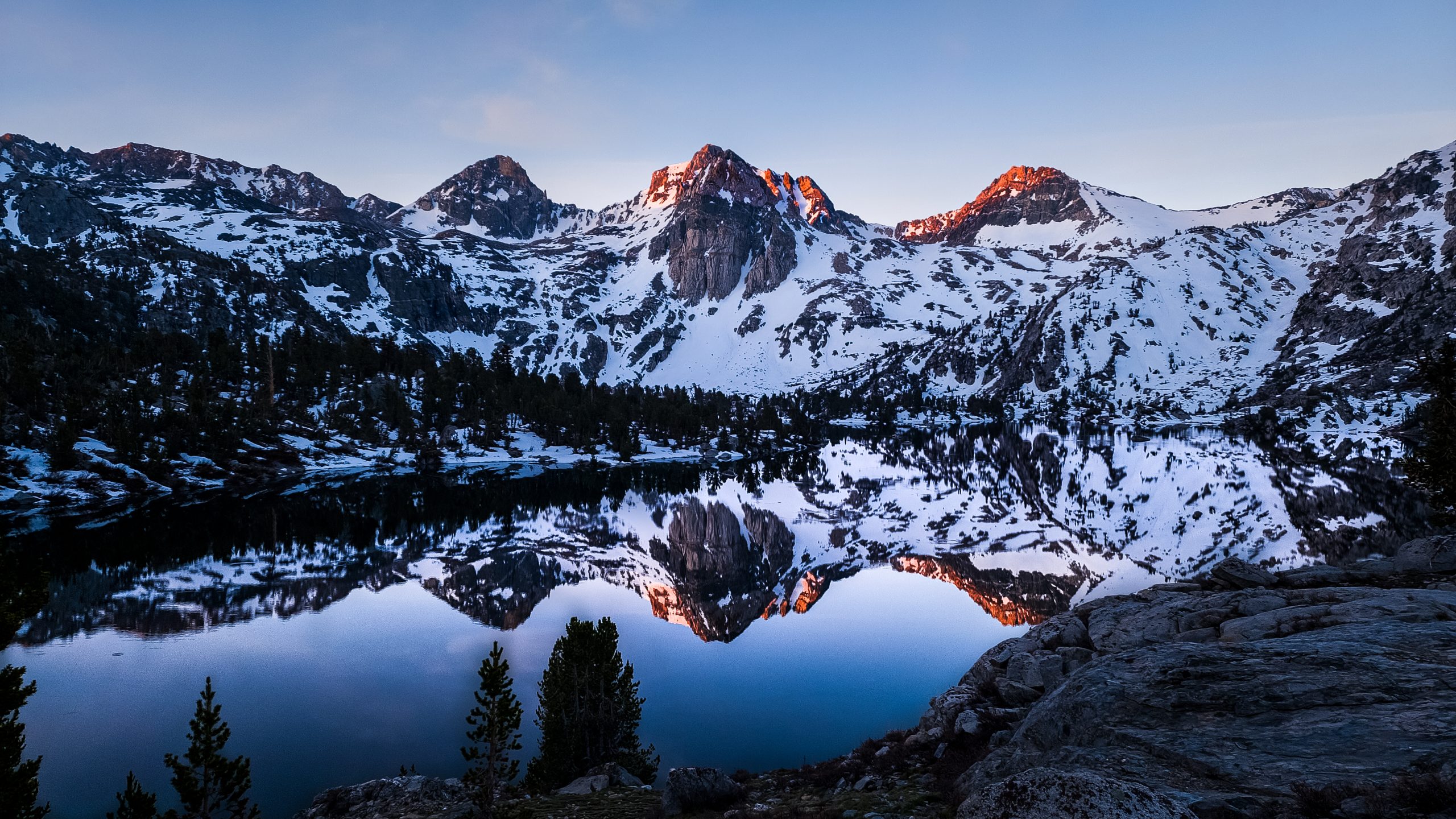
Sun at Fin Dome Peak and Lower Rae Lake
Finding My Friends
As I was taking a photo, I spotted a group of tents close together—and there they were: Saida and the rest of my trail family. They were just starting to wake up. The first one to see me was Rafael, who was already performing his morning ritual, which from what I could tell at a distance, involved coffee.
I walked over to their campsite, dropped my pack, and waited while they finished packing up. Salty Chef was really happy to see me and asked:
“Where did you camp last night? At the first site? We were planning to stop there but ran into some hikers who said there was no one down that way, so we kept going.”
I looked at him, a bit surprised, and said:
“Ah, they probably didn’t check too far down—I was right next to the bear box, close to the lake shore. It was a stunning spot and had a perfect dining area for Jumper.”
Jumper overheard me and laughed:
“Oh Diego! I made the dining area here and we even left a rock in your honor. But it looked more like a gravestone than a monument, so we took it down. LOL.”
We all laughed as they continued packing.
Walking Together Again
We started walking as a group, catching up on everything that had happened in the past few days. The vibe was good. You could tell there were some new people, which made things feel a bit different—like when a new coworker joins and you’re all figuring out how to work together again.
I told them about my wild descent from Glen Pass. They had seen the glissade track and said:
“Whoever did that glissade must’ve been nuts! Hatchet wanted to try, but it looked so steep and rocky at the bottom, he backed out.”
They laughed even more when they found out that “crazy kid” was actually a Roadrunner—me—who had slipped and lost some feathers sliding out of control on the ice.
Today’s Menu
Today’s stretch was the longest we’d had so far in the Sierras. Basically, we’d be walking along a valley until we hit a wall of mountains guarded by the towering Window Peak and Pyramid Peak.

Once we reached that wall, we’d climb up, turn right, and continue through another massive valley until we hit Pinchot Pass at 12,100 feet. Since most of the trail was through valleys, we didn’t need to stay together all the time. The group spread out, and we’d check in with each other every so often.
I started walking with Saida and asked her how the trail had been for her lately. She said she was happy to be back on the trail after feeling overwhelmed in the city. The break had been good, but the house had too many people and she felt a bit compressed there. Out here, things were flowing again. Simba and Mufasa were really strong hikers, usually leading the way.
Simba was clearly thrilled to be hiking with his dad, who had joined for this tougher section of the PCT. It’s not common to see a 12-year-old alone in the mountains, but watching their dynamic, you could tell he was more than ready. And now, walking with his father and the group, he felt safer and more involved.
The Washout
We kept descending, and the mountains on the horizon started growing taller. The Sierra landscape was a dream. The terrain kept changing, offering new views with every mile.
We found ourselves in a wide-open valley, where trees were beginning to reclaim space. Browns and greens were starting to overtake the whites of snow and the grays of the rocks. Birds sang joyfully, darting across the trail.

Window Peak, Pyramid Peak and White Fork Saddle
Rafael, too, had settled in well. Saida told me he had insisted on being called “Coyote,” and eventually Jumper made it official by giving him the trail name. Coyote was happy to be there, though he was a bit slower than the rest—which was totally understandable for someone 62 years old and only a week or so into the trail.

The washout on trail
Then we hit a section known as a “washout.” That’s what they call it when a landslide or snowstorm wipes away the visible trail. Here, hundreds of trees had fallen. You had to scramble over trunks, and every now and then, you could glimpse the trail hidden in the brush.
The River Crossing
I waited for Rafael to help him through the washout. He was very thankful and looked more winded than the others. He told me he didn’t want to fall behind because he was worried about losing the trail or missing a river crossing. I reassured him—we were in this together, and we’d wait for each other if anything tricky came up.

Los cruces de rios se volvieron más agresivos
He said,
“I walk slower, but I don’t take as many breaks. So I always catch up. I’m in great shape—strong enough for this.”
I told him this wasn’t a race. We were a team, and we weren’t going to leave anyone behind. I also asked how his pack was feeling, in case he needed help.
He said he packed just the essentials and had followed every ultralight tip from the pros. That, combined with his experience in the mountains and trail running, made him fully ready. His response felt a bit defensive though—like he needed to prove something no one had questioned. So I let it go.
Different Perspectives
Then he added,
“I only packed five days of food instead of six. People always have extra, so I’m sure someone will share.”
That did bother me. It felt selfish. Sure, no one in the group would mind sharing a little if needed—but there’s a difference between falling short by mistake and planning to rely on others. This was the toughest stretch of the PCT, with a dangerous mountain pass, a detour due to a broken bridge, and a lot of uncertainty. Choosing to bring less food than needed didn’t sit well with me.
I told him:
We’re here to reach our goal together, and that takes effort from all of us. Most of this journey is a solo challenge. It’s not a guided tour. We’re out here by choice, each of us walking our own path.
He didn’t like that much and simply replied,
“Don’t worry, the trail always provides.”
I really don’t like that answer too
Flowing Like Water
When we reached the second valley, I walked alone for a while to clear my head. Soon after the climb began, I came across an incredible waterfall—the Woods Creek Waterslide. The force, speed, and roar of the water were overwhelming. When the stream changed direction, it crashed into rocks, sending waves well above my height.

Woods Creek Waterslide
Watching it, I realized my thoughts needed to flow too—to move past that conversation. My way of experiencing the trail clashed with Coyote’s, but that didn’t mean I was right and he was wrong. They were just different approaches to the same journey.
I’m not some wandering judge with a scale in one hand and a whip in the other. I’m just another soul walking this world in the way I believe is right. Others may choose different paths, and that’s their right. I’ll cross paths with them, observe their way, and decide what—if anything—I want to take from it.
That, too, is a lesson from the PCT, Roadrunner.
Approaching Pinchot Pass
The climb to Pinchot Pass was long but not dangerous. The trail had plenty of switchbacks and very little snow, making the ascent easy, though time-consuming. Salty Chef, Hatchet, and Jumper reached the summit first and waited for the rest of us.

Salty Chef and Hatchet at Pinchot Pass
Soon after, Simba and Mufasa arrived. They sat on a rock, had a snack, and waited for the others to catch up.

Simba and Mufasa at Pinchot Pass
As we ate, we saw two distant dots slowly growing larger. The one closest to the pass was Saida, with her signature scarf-wrapped trekking poles and her bright violet clothes—the look that earned her the trail name “Lupine,” after the flowers of the same color.

Saida llegando a Pinchot Pass
Fifteen minutes later, Rafael’s silhouette became visible. He moved carefully across the snow, searching for stable footing.
When I saw him, I started singing soccer chants from back home—just like I had on Forester Pass:
Soy Celeste soy! soy soy Celeste
Somos de la sangre de Maracana
Somos la locura que picó el penal.

Rafael close arriving to Pinchot Pass
All Together Now
When Rafael reached the top, he hugged me and said, “Thanks a lot, negrito, for the support.”
That greeting warmed my heart. It was affectionate, and any earlier tension was gone. Good vibes had once again won the day and lifted the mood.
We were all together at the summit, exhausted from the long hike, river crossings, and fallen trees—but happy to be there. Now it was time to descend, leave the snow behind, and prepare for the next big challenge.

The first view of Mather Pass Mountains
Tomorrow, Mather Pass awaited us—the most intimidating climb in the Sierra Nevada.
Even before starting this trail, I knew there was one day, one mountain pass, that was going to be particularly difficult. It’s a common question among hikers: what’s the most challenging part of the trail? The common answer among most people was always the same—Mather Pass.
The night before, we studied the pass together with Saida, Salty Chef, and Hatchet.
In terms of distance, it didn’t seem like a challenge at all. We had camped at a strategic spot that would allow us to reach the pass around midday, following our usual plan.
The pass wasn’t even particularly high. But what the map clearly showed were tightly packed contour lines—both going up and coming down. Saida told us not to worry too much about the descent, since there was a kind of natural staircase on that side. That stretch was known as the Golden Staircase and likely had little or no snow.
The Difficulty
The real problem was clear—once we reached the head of the valley, the ascent would be the most delicate part and demanded our full attention.
We were a big group, and after two days of hiking together, we already knew what our potential problems would be. We had a pretty wide range of hiking speeds: Simba and Mufasa were the fastest, while Rafael was the slowest and the least stable on his feet.
In an area with snowy ledges, we had to be extra careful—one mistake could mean a serious accident.
The Strategy
So we agreed on a plan. During the climb, Salty Chef and Jumper would go ahead and break trail. Hatchet would help find the best path for the group, with Simba and Mufasa supporting. I’d stay in the middle to bridge the two groups, and Saida would be close to Rafael.
If we stuck to that plan, everything should go smoothly.
Starting the Day

South Fork Kings River
The trail started out peacefully, winding alongside the South Fork Kings River. At one point, Mufasa realized the trail unnecessarily crossed the river twice, which meant doing two river crossings just to keep going. He suggested we stick to the right side of the river to avoid getting wet. It seemed like a solid idea, so we followed his lead—and stayed dry a little longer.

Rafael, Salty Chef, Simba and Mufasa
From there, it didn’t take long for us to enter snowy terrain and reach the head of the valley, where the real challenge began.
Head of Valley

First view of Mather Pass
The scenery was once again breathtaking. We were deep in the mountains, surrounded by snow. Trees were sparse. Unlike other mountain passes, this one was clearly visible—it was obviously the lowest point in the entire ridgeline.
We gradually fell into the formation we had agreed on. What worried us was Rafael. He kept falling, even in places that didn’t seem particularly dangerous. At first, we thought it was bad luck, but as it kept happening, we started observing him more closely and saw how easily he lost balance.
We had already been hiking for quite a while, even through snowy peaks in the desert section, which had prepared us for this. But Rafael had started at Tehachapi, so he lacked all that earlier experience. We figured that was part of the reason for his instability.
Time to Climb
We took a short break, got into formation, and began the ascent. As expected, the steepness of the trail was the real issue. We had a clear view of the pass, but figuring out which path would require the least effort was tough. Salty Chef and Jumper kept switching positions and routes—sometimes following tracks in the snow, other times scrambling up cracks in the rocks.

A Lion in the Making
The group began to spread out. Salty Chef and Jumper were already several meters ahead. I was with Hatchet, trying to find the best route for the others. At one point, we chose to follow some tracks that climbed more gently. While zigzagging, we realized Saida and Rafael were no longer in sight. We told Salty Chef to wait for us. He sat down on a flat area, and we regrouped there.
Regrouping

Looking for Saida and Coyote
We sat there scanning the slope but couldn’t see anything. With such a steep trail, they could’ve been stuck at a switchback and completely out of view. Five minutes passed. Then ten. Then fifteen. Still nothing. We started to worry. Mufasa insisted he had just seen them not long ago. But it was too much time. I dropped my pack and started heading back down. I had only walked about ten meters when—I saw them!

Saida and Coyote down there
They were moving slowly, but they were moving. Saida looked up and gave me a smile that immediately calmed me down. Clearly something had happened, but it seemed under control now. Rafael’s backpack was badly tilted to one side, and he was gripping his ice axe with all his strength. I noticed he was holding it the wrong way—but that wasn’t the time to correct him. First, we had to get them to our spot. The hardest part of the trail was right in front of us.
After a few minutes, they reached us and sat down. They looked exhausted, so the best thing was to rest for a bit.
Assessing the Situation
I walked over to Saida and asked how she was doing. She said she was okay, just tired from the effort—and because she had to catch Rafael when he fell.
My reaction was immediate:
“What do you mean he fell? What happened?”
She explained:
“He was ahead of me by a few meters, and he tripped and fell down the snow-covered slope. He tried to stop with his ice axe but doesn’t know how to use it, so he couldn’t self-arrest. He started sliding. I left the trail and barely managed to grab him and dig my ice axe into the snow. Luckily, it wasn’t the steepest part of the slope—otherwise it could’ve been much worse.”

View of the Valley
I saw the fear in her face and the seriousness in her eyes. What had happened was very serious, and it was pure luck that Saida had been there. It’s a real blessing to have someone like her in the group—someone who truly cares and has strong mountain skills. She’s one of the few people I’d trust with my life on a serious climb. It made me think of my friend Lupine.
I told her:
“Saida, that was incredible. It’s so dangerous to be up here without knowing how to use the ice axe. I didn’t know how either before the PCT, but I practiced in safe areas along the way. Now, let’s stay really tight as a group. We’ll put Rafael in the middle. I’ll show him how to hold the axe properly.”
We fist-bumped, and she kept resting a bit more.
Helping Coyote
I went over to Rafael and asked how he was doing. He told me he was feeling great now—that he had just tripped and fallen but held on tightly to the ice axe to stop the fall.
I didn’t want to get into the details, so I simply explained how to properly hold the axe. From now on, he had to hold it with his left hand and only use one trekking pole. We were putting him in the middle of the group, and the final stretch had very few safe spots to stop.
He nodded and said:
“Saida is amazing! She helped me a lot.”
I replied:
“Yeah, she’s an excellent mountaineer.”
The Final Stretch
We got into formation as planned. Salty Chef, Jumper, Simba, and Mufasa led the way. Then Hatchet, me, Rafael, and Saida.
I walked slowly, placing each step carefully, trying to make short, solid footprints for Rafael to follow. The terrain was very unstable—sometimes the snow would hold, sometimes your foot would sink. My ice axe often went in all the way to the handle, and I’d have to pull it out and look for firmer ground.

A difficult trail
Each step was tough, but we kept moving forward. Little by little, we got closer to the pass. I could see Simba up ahead, standing still and pointing out where to climb. The final steps were the hardest—the snow collapsed under your feet, and you had to use your hands to pull yourself out of constant holes.
This series of small steps and efforts brought us to safety…

View from Mather Pass

Hatchet, Salty Chef, Jumper and another hiker at Mather Pass

Rafael at Mather Pass
WE DID IT — WE WERE AT THE TOP OF MATHER PASS, SAFE AND SOUND.
Time to Go Down
After savoring the sweet taste of victory atop Mather Pass, we quickly shifted our focus to the next goal: getting out of the cursed snow and finding a suitable spot to pitch our tents.

Saida at Mather Pass
As Saida had warned, the start of the descent was tricky. The initial slope was long and steep. In the distance, we could already see our target. Getting there was going to be a slow and careful process if we wanted to stay safe and avoid ankle twists. Or… we could consider a much more fun alternative.
 Glissade to the victory
The group’s morale was sky-high. You could feel the joy in the air—which, at that point, didn’t feel cold at all. It felt warm with confidence and ease. We were growing comfortable in this new terrain. So we decided to sit on our butts and glide down the slope in a snowy glissade to the very end of the snowfield.
The golden stairway
 Saida happy outside of the snow
Thanks to this descending technique, we moved more quickly and saved lots of energy. We slid down in small groups and regrouped at lower points. Once we made it out of the snowy area, we encountered what Saida had told us about earlier—the Golden Staircase. It was a long series of stone switchbacks carved into the mountain. The trail was partially covered with snowy patches and led directly toward a series of frozen lakes.

Golden Stairway
Now out of the more dangerous zone, Salty Chef proposed a little game: we would each go at our own pace to the campsite. A curious proposal given the day we had, but honestly, it sounded fun. As soon as the game was announced, he and Hatchet took off with incredible speed.
The game begins
I joined up with Saida and Jumper, and we also picked up the pace. Back home, I’d trained a lot on downhill trails since my knees always gave me trouble. In particular, I’d followed advice from Lali Moratorio, a well-known trail running coach in Uruguay.
Gradually, I let myself go a bit faster. At one point, Saida and Jumper, who were ahead of me, stumbled slightly—and I passed them. That’s when I really let loose with my downhill trail running skills. Just like I had done so many times on the PCT over the past month.
I soon lost sight and sound of Saida and Jumper. All I could hear were the faint echoes of their laughter. Then I continued on alone, jumping over branches, rocks, and roots.
A few switchbacks later, I caught up to Salty Chef and Hatchet.
I tucked in behind Salty Chef, who turned around and exclaimed:
“Holy shit! When did you catch us?”
Walking fast in family
I laughed and said, “I love cutting loose on the descents, LOL. I feel really confident now.”
Hatchet asked, “Do you want to go ahead?”
“Not at all,” I replied. “Let’s go together at a good pace and help each other find the trail.”
So we did. The Dutch father and son had impressive physical strength, and I wasn’t far behind. We moved at a fast hiking pace—almost a light jog. At one point, Salty Chef said:
“This is exactly what I needed! Freedom feels so good.”
I laughed, and we kept going. Then Hatchet asked if I usually hiked this fast. I told him sometimes, yes. He nodded and said:
“Now I understand why they call you Roadrunner.”
Campsite a la vista
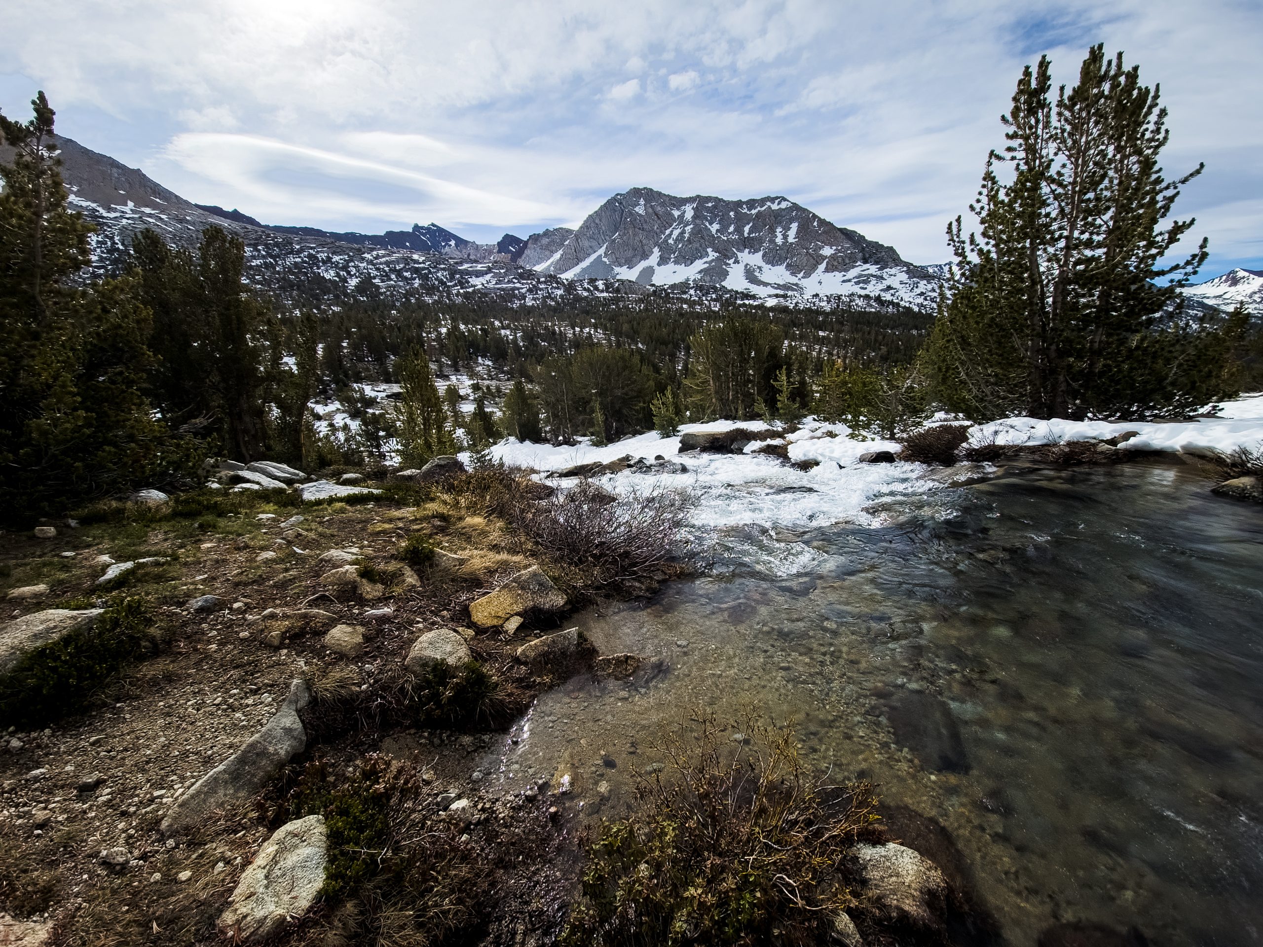
A little over an hour into the “game,” we arrived at a spot with great potential for an 8-person campsite. There we met a solo hiker named Two Bucks, who was hiking sections of the PCT after completing the CDT the year before. She was jumping around to meet friends in towns along the way.
“I’ll do the Up & Down variant too,” she told us, “but probably over two days. I’m not as fast as you guys.”
We laughed and told her that she was probably faster than us when we were with the full group.
The rest of the group
Twenty minutes later, Saida and Jumper arrived, followed by Simba and Mufasa five minutes after them. We had already set up the tents and started assembling the kitchen area.
Mufasa helped Simba pitch his tent and told us he’d go back to see if Coyote needed help. Salty Chef offered to join him. Meanwhile, we helped Hatchet work his fire-starting magic.
A victory fireplace

Hatchet and Jumper at the fire
Ten minutes later, Salty Chef, Mufasa, and Coyote returned. Everyone was okay, but they’d had a minor mishap with a river crossing. Coyote had slipped while stepping on some rocks and got a bit wet. His pants and part of his backpack were soaked, so he laid them near the fire to dry.

Two Bucks joins to the campfire
Hatchet trailname
As we relaxed around the fire, we finally heard the story behind Hatchet’s trail name. They used it so often I thought it was his real name—but come on, even if they speak Dutch in the Netherlands, Hatchet didn’t sound like a likely given name.
Turns out, he and his dad had loved building campfires from the start of the PCT. So much so that Hatchet actually carried a small axe to chop firewood along the way.
This guy was incredibly strong. He carried a two-person tent with poles—definitely not an ultralight setup. I’d never seen him complain. He was a powerhouse. You could see how proud his father was. Their bond was beautiful to witness and truly nourishing to the soul. This journey was clearly forging an inseparable connection between them.
Dinner time

Simba looking at the Fire
In the kitchen area, we cooked our well-deserved victory ramen bombs. Now that the adrenaline had worn off, the exhaustion was kicking in. We’d been hiking for nearly 11 hours with several high-tension moments. Physically we were okay, but we needed real rest to tackle the next day. So after eating, we created a rock cave to store our bear canisters and went to sleep.
Nature’s Collision
Behind my tent, I could hear water rushing loudly. After setting up, Salty Chef and Saida joined me to investigate the source
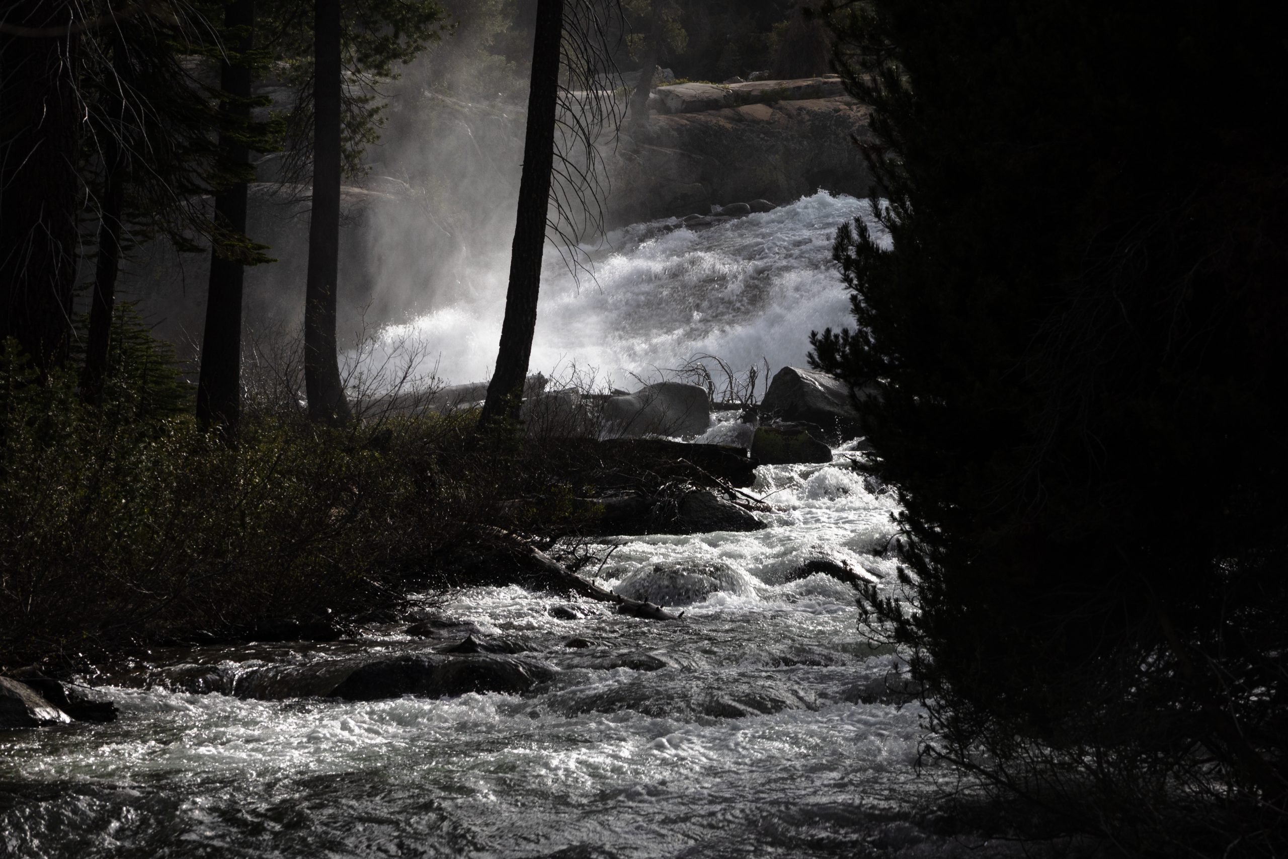
Middle Fork Kings River and Palisade Creek Junction
What we found was an incredible natural collision—two rivers crashing into each other head-on, forming a much larger river. Palisade Creek (the valley we’d just descended) and the Middle Fork Kings River (the one we would follow uphill tomorrow) met in a powerful confluence to become the Upper Middle Fork Kings River.
We stood there for a while, mesmerized, gathering and filtering water. Or rather, they filtered water. Since arriving in the Sierra, I’d decided not to filter my water unless it was stagnant or suspicious. So far, that hadn’t been the case.
A little debriefing
We took advantage of the peaceful moment to reflect on the day. We all agreed that it had gone really well. Every challenge had been met with decisiveness and calm.
Salty Chef told me something unexpected:
“You don’t know this, Roadrunner, but Hatchet and I didn’t have much trekking experience before the PCT.”
That floored me. They didn’t look inexperienced at all—they carried themselves with confidence and clarity. Clearly, they’d learned a lot on trail. They were open to listening, learning, and growing. On top of that, Salty Chef had a natural talent for leadership. He knew how to talk to people and find common ground. He was truly impressive.
The next step Muir Pass
I say, “Tomorrow is another big day—Muir Pass! The mountain pass named after the father of U.S. National Parks. It must be stunning, but it’s also going to be a challenge. It’s nearly as high as Mather Pass, but with a much gentler slope, meaning we’ll encounter a lot more snow.”
They looked at each other and nodded. I added:
“We need to be careful with our start time. Tomorrow we don’t just need to reach the pass—we also have a long snowy descent to complete. Ideally, we’ll make it to the area near the fallen bridge to camp. Though another option might be to stay at the shelter.”
Saida added:
“Yeah, true. Muir Hut is meant for emergencies, but depending on how the group’s doing, it might be best to stop there and descend the next day for a more relaxed Up & Down.”
Salty Chef simply looked up, let out a sigh, and said:
“Alright! We did great today. Let’s rest and see how things go tomorrow.”
We walked back to our tents, and that night, we fell asleep almost immediately.
We woke to a beautiful morning. The sun filtered through the trees, and everyone got up on time. Still, there was a hint of sadness in the air—today we were going to say goodbye to a beloved trail companion. Mufasa had to head home and return to work. He felt reassured, though, knowing his little lion was strong, doing well, and surrounded by people who cared. He planned to hike with us to the Bishop Pass junction, then exit the PCT to return to the city.
Simba’s plan was to continue with us through the Sierra. We were going slower than he preferred, but for now, he was happy with the group.
Two Bucks’ tent remained still. She was probably still sleeping—we’d likely see her later that day.
Bishop Pass Junction

PCT and Bishop Pass Junction
We reached the intersection of the PCT and Bishop Pass fairly quickly. I felt a pang of sadness thinking about Mufasa leaving. His strength and willingness to be out here, supporting his son’s dream, seemed nothing short of extraordinary. Simba was just twelve years old! I thought about how, in my city, parents don’t even let kids that age walk to school alone. Yet here he was—cooking for himself, hiking, and camping out in the wild. Although… come to think of it, that might actually be safer than crossing a city street. Maybe these parents weren’t so crazy after all.

Simba
Simba didn’t seem worried or sad. He stood quietly, watching the trail ahead.
Mufasa offered his leftover food to the group. Coyote stepped forward and grabbed as much as he could—he had been one day short on food, so the extra rations were a gift.
As he passed by me, he smiled and said:
“Like I told you, Roadrunner—the trail provides.”
I laughed but didn’t take the bait.
Then something else caught my attention.
Salty Chef and Saida were sitting on a rock, deep in discussion. They were poring over the map and calculating distances. Nothing unusual there—but the conversation was taking a while. I assumed they were planning the route ahead, maybe reviewing the Up & Down section.

Salty Chef, Saida and Mufasa
A few minutes later, Salty Chef called us over.
“As you know, we’re at the Bishop Pass junction. Mufasa is heading out here toward the town of Bishop. Simba, you’re more than welcome to stay with us and continue on.”
Simba nodded.
Salty Chef continued: “This is also a crossroads. One path is filled with uncertainty—there’s a broken bridge and some risky sections ahead. The other is a safer route that almost every hiker is now taking. I have to be honest with you all. I’ve been feeling really tired lately. This is a big group, and the trail has been tougher than I expected. That’s why, after discussing it with Saida, we think a good option would be to exit here via Bishop Pass, rest up in town, and re-enter the trail through Piute Pass. Some of us are also running low on food, and we don’t know what lies ahead. This alternative gives us more certainty. But I’d love to hear your thoughts.”
A silence followed. Looking around, I didn’t see any frustration or resistance on the faces in the group.
My Turn to Speak
Inside my head, a storm of thoughts was brewing. I hadn’t expected Salty Chef to suggest this.
I finally spoke up:
“I think what Salty Chef is proposing makes a lot of sense. The Bishop Pass route offers more certainty. And I really appreciate how openly you’re sharing this—it’s not easy carrying the weight of making decisions for a group this size. But we’ve all chosen to be out here and challenge ourselves as hikers. That means everyone has a voice, and no one person has to carry it all.”
Everyone nodded in agreement. Jumper added that he wasn’t here to take reckless risks. He loved this group and would stick with it.
Salty Chef thanked us, and then said:
“Alright, then. Raise your hand if you’re heading out through Bishop Pass.”
The hands went up, one after another:
- Salty Chef
- Hatchet
- Jumper
- Coyote
- Mufasa
- Simba
After a moment of hesitation… Saida raised her hand too.
My Thoughts
So many thoughts rushed through my mind. The safer route. My talk with High Five and Ian, where they said Bishop Pass was the smartest move. I remembered how sure I was of that choice when I left their house—until they themselves convinced me to go through Muir Pass.
And then there was this group. This beautiful, chaotic, joyful little trail family.
The shared dinners. The fires Hatchet built. The long talks with Saida. Watching the father-son bond between Mufasa and Simba grow stronger each day. The way we all helped each other. This was the perfect group for me. I felt deeply at home.
But in my heart… there was also the pull of the challenge. The call of Muir Pass. The unknown.

Sierras view
I stood there at a real Crossroad in the Sierra—a safe path with the people I’d grown to care about, or the wild terrain ahead, full of doubts and discomfort… far beyond my comfort zone. And I’m someone who always chooses the path of planning and certainty.
With that thought in mind…
I hope you’ll stay with me and come back for my next post, where I’ll finally reveal the decision I made. I’d love to know what you think after everything you’ve read so far. This is only the beginning, and I’m so excited to keep sharing my PCT journey with you.
Thank you, everyone.


