
Sometimes you just want to go for a good backpacking trip without having to quit your job or leave your entire life behind. I’ve handpicked shorter backpacking trails from every region of the United States, ensuring that no matter where you are, you’ll find the perfect route for your next adventure.
Each trail offers its own blend of scenic vistas, manageable challenges, and pockets of tranquility. These routes are chosen not only for their natural beauty but also for their accessibility, as they allow you to take an adventure without derailing your everyday commitments.
Hikes By Region
West
The Enchantments
Distance: 19.25 miles
Elevation Gain: 5,500 ft
Type: Point-to-Point
The Enchantments is a breathtaking alpine wonderland located in the Cascade Mountains of Washington. This area is renowned for its crystal-clear lakes, jagged granite peaks, and vibrant golden larches in the fall. The hike is challenging yet rewarding, offering stunning vistas of Colchuck Lake, Snow Lake, and the Core Enchantments Basin, where pristine alpine lakes are scattered among rugged rock formations.
The trail is known for its steep ascent up Aasgard Pass and technical terrain, requiring hikers to navigate rocky paths and significant elevation changes. Due to its popularity and fragile ecosystem, overnight camping requires a highly competitive permit, making it a sought-after destination for those looking for a spectacular backcountry experience or a particularly demanding day hike.
Trans Catalina Trail
Distance: 38.5 miles
Elevation Gain: 7,900 ft
Type: Point-to-Point
The Trans Catalina Trail is a scenic coastal trek spanning Catalina Island off the coast of Southern California, renowned for its sweeping ocean views, rugged hills, and diverse wildlife, including bison and bald eagles. This challenging yet rewarding hike offers breathtaking panoramas of the Pacific Ocean, secluded beaches, and dramatic cliffside vistas as it winds along remote valleys and ridgelines.
The trail is known for its steep ascents and descents, exposed terrain, and limited water sources, requiring careful planning and preparation. With multiple campsites along the route, the Trans Catalina Trail provides a unique backcountry experience, blending coastal beauty with rugged island adventure.
High Sierra Trail
Distance: 72 miles
Elevation Gain: 15,000
Type: Point-to-Point
While the High Sierra Trail may be a bit much for one weekend, you certainly won’t have to quit your job to tackle it considering many people do it in as few as 5 days. Stretching 72 miles from Crescent Meadow in Sequoia National Park to the summit of Mount Whitney, the highest point in the contiguous United States, this trail offers an unforgettable journey through the heart of the Sierra Nevada. Hikers are rewarded with awe-inspiring views of granite peaks, lush meadows, and alpine lakes, including the stunning Hamilton Lakes and the dramatic Kaweah Gap.
The trail is known for its steep elevation gains, remote wilderness sections, and the challenging climb up to Mount Whitney’s summit. Permits are required, and weather conditions can be unpredictable, adding to the sense of adventure on this iconic trans-Sierra route.
Lost Coast Trail
Distance: 25.5 miles
Elevation Gain: 1,000
Type: Point-to-Point
Timberline Trail & Mount Hood
Distance: 41.5 miles
Elevation Gain: 10,800
Type: Loop
The Timberline Trail is an epic loop around Oregon’s Mount Hood that gives you nonstop views of the mountain’s snowy summit while taking you through some of the most beautiful and varied terrain in the Pacific Northwest. Clocking in at about 40 miles, this trail has it all—lush forests, open meadows bursting with wildflowers, rugged alpine ridges, and river crossings that are as thrilling as they are nerve-wracking. It’s a constantly changing landscape that keeps things interesting around every bend.
But it’s not without its challenges; those river crossings can be sketchy, especially when glacial melt is running high, and some parts of the trail are steep, washed out, or just plain tough. You’ll need good navigation skills and a sense of adventure to tackle this one. But for those who are up for the challenge, the Timberline Trail delivers unforgettable views and a true sense of wilderness that make every tough mile worth it.
This trail also overlaps with the Pacific Crest Trail, if you’re looking for a little taste of the PCT. Photo: Sydney Brehm
Mountain West
Four Pass Loop
Distance: 26 miles
Elevation Gain: 7,300
Type: Loop
The Four Pass Loop is a jaw-dropping circuit in Colorado’s Maroon Bells-Snowmass Wilderness that packs in some of the best alpine scenery you’ll find anywhere. At about 28 miles long, this trail lives up to its name by taking you over four high mountain passes — West Maroon, Frigid Air, Trail Rider, and Buckskin — all hovering around 12,500 feet. Each pass serves up panoramic views of rugged peaks, turquoise alpine lakes, and endless wildflower meadows that feel like something out of a postcard.
But don’t let the beauty fool you: this loop is a serious workout. The steep ascents and descents are tough on the legs and lungs, especially at high altitude. Afternoon thunderstorms are no joke either, so early starts are a must. It’s a challenging but insanely rewarding trek that gives you a front-row seat to some of Colorado’s most iconic landscapes.
Teton Crest Trail
Distance: 40 miles
Elevation Gain: 9,500 ft
Type: Point-to-Point
The Teton Crest Trail is a spectacular backcountry route that threads its way through the heart of Wyoming’s Grand Teton National Park, delivering non-stop views of jagged peaks, lush meadows, and shimmering alpine lakes. Spanning about 40 miles, this trail takes you along the spine of the Teton Range, with jaw-dropping panoramas of the Grand, Middle, and South Teton towering above.
You’ll cross high mountain passes like Paintbrush Divide and Hurricane Pass, where the sweeping views are nothing short of epic. The wildflower-covered meadows and chance encounters with wildlife like moose and black bears make this hike even more unforgettable.
Challenges include steep climbs, rocky trails, and rapid weather changes that will keep you on your toes. Plus, the high elevation can be a lung-buster if you’re not acclimated. With limited campsites that require hard-to-get permits, the Teton Crest Trail is as challenging to plan as it is to hike, but it’s well worth the effort for those craving big mountain adventure.
Cirque of the Towers
Distance: 19 miles
Elevation Gain: 2,100 ft
Type: Loop
Cirque of the Towers is the kind of place that makes you feel like you’ve stumbled into a fantasy novel. Tucked deep in Wyoming’s Wind River Range, this loop isn’t long — about 20 miles — but it packs in enough jaw-dropping scenery to leave you speechless. Think jagged granite spires that look like something out of Middle Earth, sparkling alpine lakes, and meadows so lush and colorful you half expect a hobbit to wander by.
The route keeps you on your toes with steep climbs, rocky paths, and high-altitude passes that’ll leave your lungs burning. When it comes to weather, the mountains like to keep you guessing, with sudden storms that can turn a sunny afternoon into a lightning show. But for those who make the trek, the Cirque delivers pure magic, with epic views and a sense of wildness you don’t find just anywhere.

The Cirque of the Towers is a popular alternate for CDT hikers as they make their way through Wyoming’s Wind River Range.
Collegiate Loop
Distance: 161 miles
Elevation Gain: 39,000 ft
Type: Loop
Another trail that isn’t exactly weekend-friendly but is still worth a mention, the Collegiate Loop is a 160-mile backpacking route in Colorado that circles the Collegiate Peaks. It’s stunning enough to be worth spending several long weekends chipping away at this loop, if need be.
It passes through some of the state’s most rugged and scenic terrain, combining sections of the Colorado Trail and the Continental Divide Trail and offering hikers a variety of landscapes. The loop takes you past several 14,000-foot peaks, including Mount Princeton, Mount Yale, and Mount Harvard, making for jaw-dropping views.
Expect some challenging stretches, including steep climbs, long ridgelines, and difficult crossings above treeline. The weather is unpredictable, with afternoon thunderstorms a common occurrence in the summer months. While the trail’s remoteness and elevation can test your endurance, the beauty of the rugged peaks and expansive wilderness makes it a rewarding experience for those prepared to take on the challenges.

The Loop covers some iconic Colorado spots, like Hope Pass, Lake Ann Pass (pictured here), and Cottonwood Pass.
Alice-Toxaway Loop
Distance: 19 miles
Elevation Gain: 3,200 ft
Type: Loop
The Alice-Toxaway Loop is a beautiful yet demanding trek located in Idaho’s Sawtooth Wilderness, offering hikers a challenging but rewarding experience. This loop takes you through some of the most scenic parts of the Sawtooths, with plenty of elevation gain as you navigate rocky ridgelines, high alpine passes, and pristine alpine lakes including the eponymous Alice and Toxaway lakes. You’ll be treated to jaw-dropping views of jagged peaks, deep valleys, and clear, turquoise lakes that could be straight out of a postcard.
The trail features steep ascents, narrow paths, and rugged terrain, with sections above treeline where the weather can be unpredictable. While the trail is demanding, it’s well worth it for those seeking a true backcountry experience in one of the most beautiful and less-travelled areas of Idaho. Just be prepared for the elevation shifts, challenging climbs, and the possibility of sudden storms.

Fredlyfish4, CC BY-SA 3.0, via Wikimedia Commons
Southwest
Paria Canyon and Buckskin Gulch
Distance: 21-51 miles (dependent on route)
Elevation Gain: 500-1500 ft (dependent on route)
Type: Point-to-Point
Paria Canyon and Buckskin Gulch offer one of the Southwest’s most unforgettable slot canyon adventures. This trail winds through narrow, winding passages carved into brilliant red rock, where light and shadow play off surreal formations that seem almost otherworldly. The unique beauty of these canyons is matched by their challenges: tight squeezes, uneven terrain, and the ever-present risk of flash floods require careful planning and timing.
For those prepared to navigate its technical sections, this hike delivers a raw, exhilarating experience in a landscape unlike any other.

Photo: OakleyOriginals
Hell’s Gate Trail
Distance: 13.7 miles
Elevation Gain: 3,200 ft
Type: Out & Back
Hell’s Gate Trail #37 is a challenging out-and-back hike located near Payson, Arizona, within the Hellsgate Wilderness of the Tonto National Forest. The trail descends approximately 2,100 feet over 7 miles to reach Tonto Creek, offering hikers a strenuous workout with steep climbs on the return journey. The area is rich in wildlife, including black bears, mountain lions, and javelinas, providing a true wilderness experience.
Due to limited shade and the absence of water sources until reaching the creek, it’s essential to carry ample water and start early to avoid the midday heat. Spring and fall are ideal times to visit, as trails can be overgrown and access is limited. Hikers should be prepared for rugged terrain and ensure they have the necessary skills and supplies for a remote backcountry adventure.
Distance: 20 miles
Elevation Gain: 3,500 ft
Type: Out & Back
The Rio Santa Barbara Middle Fork and West Fork trails offer hikers a challenging and scenic experience in New Mexico’s Carson National Forest. Starting from the Santa Barbara Campground near Llano, the combined out-and-back route begins on the Middle Fork Trail (#24), leading hikers through dense forests and along the river’s edge. You’re then guided into expansive meadows adorned with vibrant wildflowers during the summer months. As the trail ascends, it crosses to the west side of the river and climbs above the canyon via gentle switchbacks, offering views of Chimayosos Peak to the northeast.
Notably, the trail passes near No Fish Lake, a shallow alpine lake situated at approximately 11,600 feet, just before reaching the Santa Barbara Divide at 12,000 feet.
Hikers should be prepared for a strenuous trek, with steep sections and potential for overgrown paths, especially in late summer. Proper preparation, including adequate water, navigation tools, and awareness of rapidly changing weather conditions, is essential.
Grand Canyon: Rim to Rim
Distance: 21 miles
Elevation Gain: 6,200 ft
Type: Point-to-Point
The Grand Canyon’s rim-to-rim hike is a bucket-list adventure that takes you from one edge of this natural wonder to the other, covering approximately 21 miles. This challenging trek involves descending nearly a vertical mile to the Colorado River and then ascending back up the opposite rim, offering hikers a chance to experience the canyon’s diverse ecosystems and breathtaking vistas.
Due to the strenuous nature of the hike, proper preparation is essential, including physical training, securing necessary permits, and planning for the significant elevation changes and temperature fluctuations encountered along the way.

Even in early April, this was a very swelteringly hot experience (albeit an incredible one!).
White Rock Springs
Distance: 23 miles
Elevation Gain: 3,000 ft
Type: Loop
The White Rock Springs Loop in Arizona’s Superstition Mountains offers a 23-mile figure-eight trail ideal for a 3-day, 2-night backpacking adventure. Starting at the First Water Trailhead, hikers traverse diverse terrains, including steep, rocky climbs with an elevation gain of approximately 3,000 feet. The area is rich in unique rock formations like Weaver’s Needle, Black Mesa, and Bluff Saddle, and is home to wildlife such as mountain lions, javelinas, and ring-tailed cats.
Spring and fall are the best times to visit, providing reliable water sources and vibrant wildflower displays. Before setting out, it’s advisable to contact the Tonto National Forest Mesa Ranger District for current backcountry water reports. Ensure you carry sufficient water, as desert conditions can be demanding.
The loop’s design allows for a base camp near White Rock Springs, enabling lighter day hikes to explore the surrounding trails. Given the numerous intersecting paths and varying trail maintenance, possessing a reliable map, GPS device, and strong navigation skills is essential.

Tom Driggers, CC BY 2.0, via Wikimedia Commons
Midwest
Greenstone Ridge Trail
Distance: 40 miles
Elevation Gain: 5,400 ft
Type: Point-to-Point
The Greenstone Ridge Trail is a 40-mile path that spans the length of Isle Royale National Park in Michigan. Starting at Windigo Harbor on the island’s western end and stretching to Rock Harbor in the east, the trail follows the island’s central ridge, offering hikers elevated views and a chance to experience the park’s diverse ecosystems. Along the way, hikers traverse varied terrains, including dense forests and open ridges, and may encounter wildlife such as moose and wolves. The trail also passes over Mount Desor, the highest point on the island.
Due to the island’s remote location in Lake Superior, access requires careful planning, including arranging boat or seaplane transportation. Hikers should be prepared for changing weather conditions and ensure they have adequate supplies, as services on the island are limited. The trail is typically hiked over several days, with multiple backcountry campsites available along the route. Permits are required for all overnight stays.
The best time to hike is during the summer months when the weather is milder, but even then, hikers should be prepared for sudden temperature fluctuations and mosquitoes.

Photo: daveynin
Elk River Hiking Trail
Distance: 15 miles
Elevation Gain: 951 ft
Type: Point-to-Point
The Elk River Hiking Trail is a 15-mile point-to-point path located on the north side of Elk City Lake near Independence, Kansas. This moderately challenging trail offers hikers a diverse experience, winding along clifftops, through ravines, dense woodlands, and along the banks of the Elk River. The trail is marked with blue paint blazes and can be accessed from two main trailheads: the northeastern trailhead below the west end of the dam across from the Fish & Wildlife Office, and the southwestern trailhead off Highway 160 south of Elk City.
Hikers will encounter steep inclines, rocky paths, and several small creek crossings, making it a rewarding adventure for those seeking a bit of a challenge. Camping is permitted in designated areas west of the gravel access roads between the trailheads, allowing for overnight trips. The trail is well-marked, but it’s advisable to carry a map and check current trail conditions before setting out.
Border Route Trail
Distance: 65 miles
Elevation Gain: 8,330 ft
Type: Point-to-Point
The Border Route Trail is a 65-mile path that traverses Minnesota’s northeastern Boundary Waters Canoe Area Wilderness, closely following the US – Canada border. Established in the early 1970s by the Minnesota Rovers Outing Club, this trail offers hikers rugged terrains, panoramic views of the border lakes, and a deep wilderness experience. It connects with the Superior Hiking Trail at its eastern end and the Kekekabic Trail to the west, forming part of the North Country National Scenic Trail.
Hikers should be prepared for challenging conditions, including steep ascents, dense forests, and potential wildlife encounters. Permits are required for overnight stays within the Boundary Waters Canoe Area Wilderness, and it’s essential to plan ahead due to the trail’s remote nature and limited access points. The best time to hike is from late spring to early fall, considering weather conditions and trail accessibility.
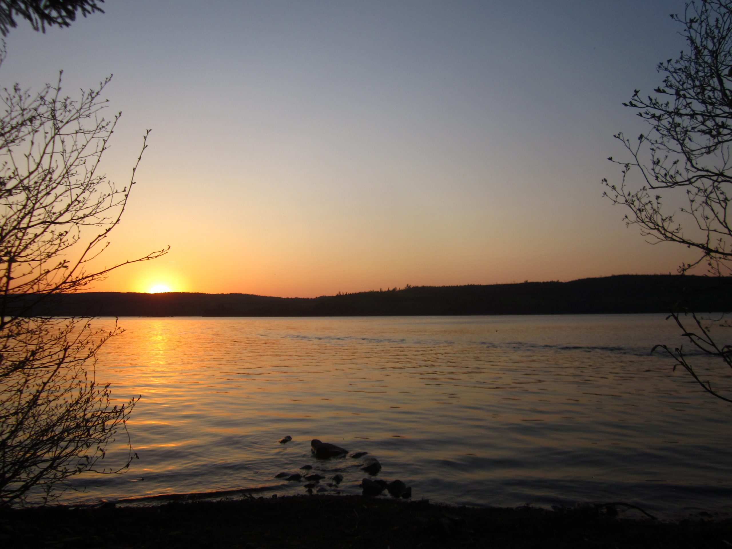
Watching a sunset on a lake in northern Minnesota is one of those experiences everyone should have at least once in life. Photo: Matt Denny
Shawnee State Forest Backpack Trail
Distance: 48.6 miles (Can vary from 21-50 miles depending on route)
Elevation Gain: 8,576 ft
Type: Loop
The Shawnee State Forest Backpack Trail, located near Portsmouth in southern Ohio, offers hikers a challenging and immersive experience through the state’s largest contiguous forest. Hikers can choose between two primary loops: the North Loop, covering about 26 miles, and the South Loop, approximately 21 miles long. Both loops traverse rugged terrain characterized by steep climbs and descents, with elevation changes reaching up to 400 feet.
The trail meanders through diverse ecosystems, including dense woodlands, clear streams, and ridge-top vistas, offering a rich and varied backpacking experience. Camping is permitted at designated sites along the trail, with self-issued permits available at the trailhead. There are no fees for camping.
Berryman Trail
Distance: 24.9 miles
Elevation Gain: 2,444 ft
Type: Loop
The Berryman Trail is a loop located within Missouri’s Mark Twain National Forest, near Potosi. This single-track path offers a moderately challenging experience for hikers, mountain bikers, and horseback riders, winding through scenic Ozark woodlands and fields. The trail features several long, sustained climbs and rocky descents, with an elevation gain and loss of approximately 2,500 feet per loop.
Notably, the western portion of the Berryman Trail overlaps with the Courtois Section of the Ozark Trail for about 12 miles. The trail is accessible year-round, with the Berryman Campground serving as a convenient trailhead offering parking and primitive camping facilities. Users should be prepared for rocky terrain, potential stream crossings, and shared use with mountain bikers and horseback riders.
Southeast
Foothills Trail
Distance: 76.2 miles
Elevation Gain: 14,341 ft
Type: Point-to-Point
The Foothills Trail is a 77-mile path winding through Upstate South Carolina and Western North Carolina, connecting Oconee State Park to Table Rock State Park. This trail offers a variety of experiences, from day hikes to multi-day treks. Hikers traverse diverse terrains, including lush forests, cascading waterfalls, and mountain vistas. The trail is well-marked and maintained, making it accessible for both novice and experienced hikers.
Notable highlights include views of the Chattooga River and Lake Jocassee. For more information, visit the Foothills Trail Conservancy.
If you don’t have the time or desire to hike the Appalachian Trail, this perfect long weekend could give you a great taste of it! Photo: Clay Bonnyman Evans
Ocean to Lake Trail
Distance: 61.4 miles
Elevation Gain: 157 ft
Type: Point-to-Point
The Ocean to Lake Trail is a 61.4-mile point-to-point trail in Florida, stretching from Hobe Sound Beach on the Atlantic coast to Lake Okeechobee near Port Mayaca. This moderately challenging route takes hikers through diverse ecosystems, including pine flatwoods, cypress swamps, and wet prairies, offering a rich experience of Florida’s natural beauty.
Along the trail, adventurers traverse several protected areas, such as Jonathan Dickinson State Park, the Loxahatchee River, and the J.W. Corbett Wildlife Management Area. These regions are home to a variety of wildlife, including wading birds, alligators, and deer, providing ample opportunities for nature observation.
Hikers should be prepared for wet conditions, as portions of the trail can be submerged, especially during the rainy season. Proper planning is essential, including checking water levels and weather forecasts before embarking. For those interested in exploring this trail, detailed maps and guides are available through the Loxahatchee Chapter of the Florida Trail Association. These resources provide valuable information on trail conditions, camping sites, and necessary permits, ensuring a safe and enjoyable journey from the ocean to the lake.

Photo: Amanda Genovese
Art Loeb Trail
Distance: 30.1 miles
Elevation Gain: 9,000 ft
Type: Point-to-Point
The Art Loeb Trail is a challenging 30.1-mile route in North Carolina’s Pisgah National Forest, stretching from the Davidson River Campground near Brevard to the Daniel Boone Boy Scout Camp near Cold Mountain. This trail, named in honor of local hiking enthusiast Art Loeb, offers hikers a chance to traverse diverse terrains, including lush forests, rugged peaks, and scenic ridgelines.
One of the trail’s highlights is the ascent over four peaks exceeding 6,000 feet, notably Black Balsam Knob at 6,214 feet and Tennent Mountain at 6,040 feet. These summits provide panoramic views of the surrounding Appalachian landscape, making the strenuous climbs rewarding. Hikers will also encounter landmarks like Shining Rock, known for its quartz outcrops, and the iconic Cold Mountain.
The trail is known for its steep ascents and descents, exposed ridgelines, and limited water sources, requiring thorough preparation. While the southern sections are well-marked, parts of the northern trail, especially within the Shining Rock Wilderness, lack blazes and signage, making navigation skills essential. Backcountry camping is permitted along the trail, with primitive shelters available at Deep Gap and Butter Gap.
Neusiok Trail
Distance: 21.1 miles
Elevation Gain: 252 ft
Type: Point-to-Point
The Neusiok Trail is a 20-mile path in North Carolina’s Croatan National Forest, stretching from the Neuse River’s sandy shores at Pine Cliff Recreation Area to the salt marshes near the Newport River at Oyster Point Campground. As the longest hiking trail in eastern North Carolina, it offers a diverse experience through cypress swamps, hardwood forests, and pocosins. Notably, the Neusiok Trail is part of the 900-mile Mountains-to-Sea Trail, which spans from the Great Smoky Mountains to Jockey’s Ridge State Park.
Hikers should be prepared for wet and muddy sections, especially after heavy rains, and be aware of local wildlife, including mosquitoes and snakes. The trail is marked with white blazes, and while it’s generally well-maintained, some areas may be overgrown, requiring navigation skills. Camping is permitted at designated sites along the trail, with shelters available at Copperhead Landing and Dogwood Camp. Before planning a hike, it’s advisable to check for any trail closures or conditions, as sections can be affected by weather events.
Buffalo River Trail
Distance: 35.5 miles
Elevation Gain: 5,830 ft
Type: Point-to-Point
The Buffalo River Trail (BRT) in Arkansas is a hidden gem for backpackers seeking a blend of natural beauty and historical intrigue. Spanning approximately 37 miles from Boxley Valley to Pruitt, the trail meanders alongside the Buffalo National River, offering hikers stunning views of towering bluffs, serene gravel bars, and the river’s edge. Along the way, you’ll encounter remnants of old homesteads, providing a glimpse into the area’s rich past.
The trail is challenging, with rugged terrain that demands a good level of fitness and preparation. Despite the effort required, the BRT rewards hikers with a sense of solitude and a deep connection to the natural world, making it a must-visit for those looking to experience Arkansas’s wild side.

Photo: Tyler Thompson
Northeast
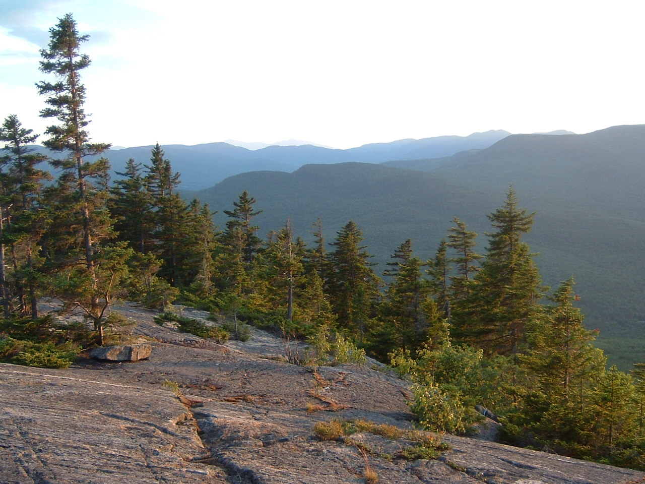
Pemi Loop
Distance: 31.2 miles (with opportunities to extend)
Elevation Gain: 9,724 ft
Type: Loop
The Pemi Loop is a classic White Mountains trek that circumnavigates the Pemigewasset Wilderness in New Hampshire. Over roughly 31.2 miles, hikers accumulate nearly 9,724 feet of elevation gain as they wind through rugged alpine terrain and steep, rocky ascents.
The route skirts the edge of the Presidential Range, offering expansive views of Mount Washington and surrounding peaks. This loop is a New England staple — challenging, technical in parts, and perfect for experienced backpackers working toward milestones like the NH48.

The trail takes you over New Hampshire’s iconic Franconia Ridge but, in my opinion, Bondcliff is even more stunning!
West Rim Trail
Distance: 30.5 miles
Elevation Gain: 5,648 ft
Type: Point-to-Point
Pennsylvania’s West Rim Trail offers a challenging journey through some of the Northeast’s most stunning high country. This point-to-point route takes you along dramatic cliff edges and deep forest valleys, providing expansive views of rugged peaks and serene wilderness landscapes. The trail’s sustained elevation gains make it a rewarding endeavor for hikers looking for a taste of remote mountain beauty, with each mile revealing new perspectives on the wild terrain of the region.
Shawangunk Ridge Trail
Distance: 68 miles
Elevation Gain: 10,328 ft
Type: Point-to-Point
Known locally as “The Gunks,” the Shawangunk Ridge Trail is a renowned route that traverses one of the Northeast’s premier rock-climbing and hiking destinations. This long, point-to-point hike features rugged, rocky terrain with steep climbs and exposed ridgelines that reward you with breathtaking vistas over the Hudson Valley and beyond.
The trail’s combination of dense forests and open, windswept expanses offers both challenging ascents and moments of serene natural beauty, making it a favorite among adventurers seeking a rugged, multi-day trek.
Great Range Traverse
Distance: 26 miles
Elevation Gain & Loss: 9,500 ft
Type: Point-to-Point
The Great Range Traverse is a brutal, yet awe-inspiring, Adirondack adventure that challenges even the most seasoned backpackers. This route crosses a chain of iconic peaks — from Rooster Comb and Hedgehog through the Wolfjaws, Armstrong, Gothics, Saddleback, and Basin, culminating at Mount Haystack and Mount Marcy.
Expect relentless Class 2/3 scrambling, muddy sections, and steep, undulating ascents under sweltering, humid conditions that demand serious hydration. While various route options exist (including shuttles or reversing the route to ease downclimbs), this full loop offers an uncompromised taste of the Adirondacks’ raw beauty and stands as one of the toughest hikes in the northeast.

Be prepared for an adventure that is as exhilarating as it is humbling. Photo: Troy Zohner
Grafton Notch Loop
Distance: 33.5 miles
Elevation Gain: 11,138 ft
Type: Point-to-Point
The Grafton Notch Loop in Maine offers a difficult and remote escape through wild, forested terrain and along dramatic mountain notches. With significant elevation gains packed into this loop, hikers will traverse challenging ascents and descents while being immersed in pristine wilderness and alpine landscapes.
The trail winds past sparkling streams, dense woodlands, and expansive views over rugged peaks, providing a quintessential New England backpacking experience that is both physically demanding and immensely rewarding.
This loop is a true Maine adventure, combining beauty with the raw challenge of backcountry hiking. Photo: Troy Zohner
Triple Crown Section Hikes
CDT: San Juans
Distance: 116 miles
Elevation Gain: 24,762 ft
Type: Point-to-Point
The Continental Divide Trail section through the San Juan Mountains in Colorado is a formidable challenge that showcases the wild, untamed beauty of the high Rockies. This 116-mile stretch is a rollercoaster of rugged terrain, steep ascents, and dramatic alpine scenery. Hikers navigate high mountain passes, traverse glaciated valleys, and are rewarded with panoramic views of the San Juans’ jagged peaks.
With unpredictable weather and large swaths of trail above treeline, this section demands thorough preparation but promises an unforgettable adventure through some of America’s most beautiful landscapes.

While this may take a little longer than a long weekend, this is the hike I recommend the most from this entire article. Photo: Lisa Slutsken
PCT: Goat Rocks Wilderness
Distance: 40 miles
Elevation Gain: 7,100ish ft
Type: Point-to-Point
The Pacific Crest Trail section through Goat Rocks Wilderness in Washington is celebrated for its dramatic volcanic terrain and alpine beauty. This 40-mile stretch winds through a high spine of rugged peaks, verdant meadows, and glacially carved valleys. Hikers experience steep climbs and technical sections that reveal breathtaking vistas of ancient, eroded volcanoes and pristine alpine lakes.
The trail’s dynamic landscape and ever-changing weather make it a true test of endurance, yet every challenging step is rewarded with views that capture the raw spirit of the Cascades.
AT: Grayson Highlands
Distance: 31 miles
Elevation Gain: 5,000ish ft
Type: Point-to-Point
The Appalachian Trail through the Grayson Highlands in Virginia is a unique blend of lush balds, rugged mountain terrain, and the charm of wild ponies roaming freely. This 31-mile section offers hikers expansive grassy vistas interspersed with dense woodlands, culminating in panoramic views of the surrounding peaks. The trail’s gradual climbs and descents provide a moderately challenging yet immensely scenic journey that captures the essence of Appalachian beauty.
Whether you’re drawn by the promise of wild ponies or the serenity of high country meadows, this section is a must-hike for any AT enthusiast who simply doesn’t have the time to walk from Georgia to Maine.
I hope this list gives you plenty of inspiration for your next adventure. Don’t blame me when this inevitably turns into you quitting your job to embark on a thru-hike!
Featured image: Graphic design by Zack Goldmann. Photos (clockwise from top left): Ruth Morley, Tiffany Chou, Katie Jackson, Katie Jackson, Katie Jackson, Katie Jackson, Sydney Brehm, OakleyOriginals


